Area Overview for WN2 5JG
Photos of WN2 5JG

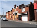
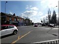
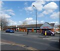
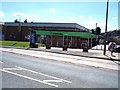
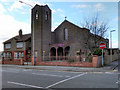
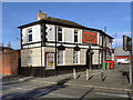
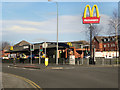
24 photos from this area
Area Information
Key information about the WN2 5JG including its size, population, and administrative classification.
- Area Type
- Postcode
- Area Size
- 1.7 hectares
- Population
- 1184
- Population Density
- 4885 people/km²
House Prices in WN2 5JG
53
Properties
£93,227
Average Sold Price
£14,000
Lowest Price
£185,000
Highest Price
Showing 53 properties
| Address | Type | Beds | Baths | Last Sale Price | Last Sale Date | |
|---|---|---|---|---|---|---|
| 48A Tram Street, Platt Bridge, WN2 5JG | Bungalow | - | - | £77,000 | Jul 2025 | |
| 93 Tram Street, Platt Bridge, WN2 5JG | Semi-detached | 2 | 1 | £158,000 | Nov 2024 | |
| 69 Tram Street, Platt Bridge, WN2 5JG | Bungalow | 1 | 1 | £118,000 | Oct 2024 | |
| 121 Tram Street, Platt Bridge, WN2 5JG | house | 2 | 1 | £78,500 | Jun 2024 | |
| 89 Tram Street, Platt Bridge, WN2 5JG | house | - | - | £115,000 | Oct 2023 | |
| 107 Tram Street, Platt Bridge, WN2 5JG | house | - | - | £81,500 | Jun 2022 | |
| 40 Tram Street, Platt Bridge, WN2 5JG | Semi-detached | 4 | 1 | £185,000 | May 2022 | |
| 79 Tram Street, Platt Bridge, WN2 5JG | Bungalow | 2 | 1 | £135,000 | Nov 2021 | |
| 87 Tram Street, Platt Bridge, WN2 5JG | house | - | - | £126,000 | Sep 2020 | |
| 70 Tram Street, Platt Bridge, WN2 5JG | Semi-detached | 2 | - | £100,000 | Dec 2019 |
Page 1 of 6
Energy Efficiency in WN2 5JG
Amenities
Schools
| Rank | School | Type | Entry gender | Ages |
|---|
Explore more schools in this area
Go to Schools tabDemographics
Household Size
Two person
most common
Accommodation Type
Houses
most common
Tenure
82
majority
Ethnic Group
White
most common
Religion
N/A
most common
Household Composition
N/A
most common
Age
47
median
Adults (30-64 years)
most common
Household Deprivation
N/A
with no deprivation
NS-SEC
20
in Lower managerial occupations
Explore more demographic insights in this area
Go to Demographics tabPlanning
Planning Constraints
- Flood RiskPremium
- Ramsar Wetland SitesPremium
- Area of Outstanding Natural BeautyPremium
- Protected Nature ReservePremium
- Protected WoodlandPremium