Area Overview for WN2 5AA
Photos of WN2 5AA
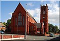
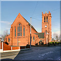


30 photos from this area
Area Information
Key information about the WN2 5AA including its size, population, and administrative classification.
- Area Type
- Postcode
- Area Size
- 4019 m²
- Population
- 2432
- Population Density
- 5814 people/km²
House Prices in WN2 5AA
17
Properties
£50,025
Average Sold Price
£26,500
Lowest Price
£78,000
Highest Price
Showing 17 properties
| Address | Type | Beds | Baths | Last Sale Price | Last Sale Date | |
|---|---|---|---|---|---|---|
| 159 Walthew Lane, Platt Bridge, WN2 5AA | house | - | - | £36,000 | Feb 2021 | |
| 165 Walthew Lane, Platt Bridge, WN2 5AA | house | - | - | £47,300 | May 2019 | |
| 198 Walthew Lane, Platt Bridge, WN2 5AA | house | - | - | £78,000 | Sep 2017 | |
| 173 Walthew Lane, Platt Bridge, WN2 5AA | Terraced | 2 | 1 | £70,000 | Aug 2015 | |
| 157 Walthew Lane, Platt Bridge, WN2 5AA | house | 2 | - | £27,500 | Apr 2014 | |
| 169 Walthew Lane, Platt Bridge, WN2 5AA | house | 3 | 1 | £61,000 | Nov 2009 | |
| 171 Walthew Lane, Platt Bridge, WN2 5AA | house | 3 | 1 | £75,000 | Jan 2008 | |
| 177 Walthew Lane, Platt Bridge, WN2 5AA | Semi-detached | - | - | £44,000 | May 2003 | |
| 155 Walthew Lane, Platt Bridge, WN2 5AA | Terraced | 3 | 1 | £34,950 | Oct 2002 | |
| 194 Walthew Lane, Platt Bridge, WN2 5AA | Terraced | 3 | 1 | £26,500 | Apr 2001 |
Page 1 of 2
Energy Efficiency in WN2 5AA
Amenities
Schools
| Rank | School | Type | Entry gender | Ages |
|---|
Explore more schools in this area
Go to Schools tabDemographics
Household Size
Family (3-5 people)
most common
Accommodation Type
Houses
most common
Tenure
56
majority
Ethnic Group
White
most common
Religion
N/A
most common
Household Composition
N/A
most common
Age
47
median
Adults (30-64 years)
most common
Household Deprivation
N/A
with no deprivation
NS-SEC
21
in Lower managerial occupations
Explore more demographic insights in this area
Go to Demographics tabPlanning
Planning Constraints
- Flood RiskPremium
- Ramsar Wetland SitesPremium
- Area of Outstanding Natural BeautyPremium
- Protected Nature ReservePremium
- Protected WoodlandPremium