Area Overview for WN2 4SB
Photos of WN2 4SB
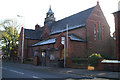
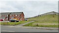
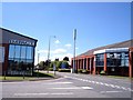
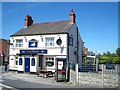
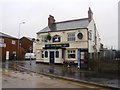
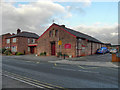
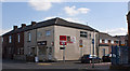
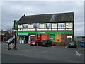
20 photos from this area
Area Information
Key information about the WN2 4SB including its size, population, and administrative classification.
- Area Type
- Postcode
- Area Size
- 1.1 hectares
- Population
- 1634
- Population Density
- 2986 people/km²
House Prices in WN2 4SB
50
Properties
£68,946
Average Sold Price
£18,000
Lowest Price
£128,000
Highest Price
Showing 50 properties
| Address | Type | Beds | Baths | Last Sale Price | Last Sale Date | |
|---|---|---|---|---|---|---|
| 804 Atherton Road, Hindley Green, WN2 4SB | Terraced | 2 | 1 | £100,000 | Aug 2025 | |
| 783 Atherton Road, Hindley Green, WN2 4SB | house | 3 | 1 | £82,500 | Jul 2025 | |
| 771 Atherton Road, Hindley Green, WN2 4SB | Terraced | 2 | 1 | £128,000 | Aug 2024 | |
| 784 Atherton Road, Hindley Green, WN2 4SB | Terraced | 3 | 1 | £100,000 | Apr 2024 | |
| 786 Atherton Road, Hindley Green, WN2 4SB | house | - | - | £80,000 | May 2023 | |
| 750 Atherton Road, Hindley Green, WN2 4SB | Terraced | 2 | 1 | £98,000 | May 2023 | |
| 754 Atherton Road, Hindley Green, WN2 4SB | Terraced | 2 | 1 | £119,000 | Mar 2023 | |
| 768 Atherton Road, Hindley Green, WN2 4SB | Retail | 2 | 1 | £81,000 | May 2022 | |
| 761 Atherton Road, Hindley Green, WN2 4SB | house | 3 | - | £80,000 | Mar 2021 | |
| 752 Atherton Road, Hindley Green, WN2 4SB | Terraced | 2 | 1 | £70,000 | Feb 2021 |
Page 1 of 5
Energy Efficiency in WN2 4SB
Amenities
Schools
| Rank | School | Type | Entry gender | Ages |
|---|
Explore more schools in this area
Go to Schools tabDemographics
Household Size
Two person
most common
Accommodation Type
Houses
most common
Tenure
73
majority
Ethnic Group
White
most common
Religion
N/A
most common
Household Composition
N/A
most common
Age
47
median
Adults (30-64 years)
most common
Household Deprivation
N/A
with no deprivation
NS-SEC
22
in Lower managerial occupations
Explore more demographic insights in this area
Go to Demographics tabPlanning
Planning Constraints
- Flood RiskPremium
- Ramsar Wetland SitesPremium
- Area of Outstanding Natural BeautyPremium
- Protected Nature ReservePremium
- Protected WoodlandPremium