Area Overview for WN2 3TD
Photos of WN2 3TD
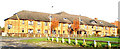
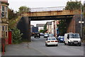
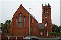
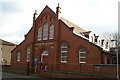
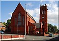
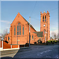
30 photos from this area
Area Information
Key information about the WN2 3TD including its size, population, and administrative classification.
- Area Type
- Postcode
- Area Size
- 5144 m²
- Population
- 2432
- Population Density
- 5814 people/km²
House Prices in WN2 3TD
22
Properties
£378,540
Average Sold Price
£25,155
Lowest Price
£6,136,000
Highest Price
Showing 22 properties
| Address | Type | Beds | Baths | Last Sale Price | Last Sale Date | |
|---|---|---|---|---|---|---|
| 9 Ridyard Street, Platt Bridge, WN2 3TD | house | 2 | 1 | £71,000 | Nov 2023 | |
| 17 Ridyard Street, Platt Bridge, WN2 3TD | Terraced | 2 | 1 | £90,000 | Dec 2022 | |
| 13 Ridyard Street, Platt Bridge, WN2 3TD | house | - | - | £80,000 | Aug 2021 | |
| 5 Ridyard Street, Platt Bridge, WN2 3TD | house | 3 | - | £6,136,000 | Sep 2019 | |
| 15 Ridyard Street, Platt Bridge, WN2 3TD | Terraced | 2 | - | £65,500 | Aug 2019 | |
| 23 Ridyard Street, Platt Bridge, WN2 3TD | house | - | - | £137,995 | Dec 2018 | |
| 25 Ridyard Street, Platt Bridge, WN2 3TD | house | - | - | £139,995 | Dec 2018 | |
| 2 Ridyard Street, Platt Bridge, WN2 3TD | Detached | 3 | 2 | £105,000 | Dec 2016 | |
| 7 Ridyard Street, Platt Bridge, WN2 3TD | house | - | - | £42,500 | Nov 2015 | |
| 16 Ridyard Street, Platt Bridge, WN2 3TD | Semi-detached | 3 | 2 | £125,000 | Oct 2014 |
Page 1 of 3
Energy Efficiency in WN2 3TD
Amenities
Schools
| Rank | School | Type | Entry gender | Ages |
|---|
Explore more schools in this area
Go to Schools tabDemographics
Household Size
Family (3-5 people)
most common
Accommodation Type
Houses
most common
Tenure
56
majority
Ethnic Group
White
most common
Religion
N/A
most common
Household Composition
N/A
most common
Age
47
median
Adults (30-64 years)
most common
Household Deprivation
N/A
with no deprivation
NS-SEC
21
in Lower managerial occupations
Explore more demographic insights in this area
Go to Demographics tabPlanning
Planning Constraints
- Flood RiskPremium
- Ramsar Wetland SitesPremium
- Area of Outstanding Natural BeautyPremium
- Protected Nature ReservePremium
- Protected WoodlandPremium