Area Overview for WN2 3EW
Photos of WN2 3EW
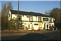
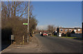
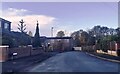
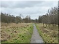
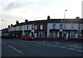
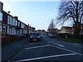
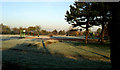
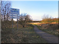
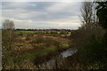
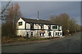
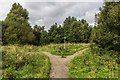
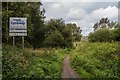
16 photos from this area
Area Information
Key information about the WN2 3EW including its size, population, and administrative classification.
- Area Type
- Postcode
- Area Size
- 1.3 hectares
- Population
- 2154
- Population Density
- 3314 people/km²
House Prices in WN2 3EW
60
Properties
£89,738
Average Sold Price
£1,130
Lowest Price
£410,000
Highest Price
Showing 60 properties
| Address | Type | Beds | Baths | Last Sale Price | Last Sale Date | |
|---|---|---|---|---|---|---|
| 142 Lord Street, Hindley, WN2 3EW | Terraced | 3 | 1 | £1,130 | Jun 2025 | |
| 110 Lord Street, Hindley, WN2 3EW | house | 3 | 1 | £165,000 | Feb 2025 | |
| 106 Lord Street, Hindley, WN2 3EW | house | 2 | 1 | £150,000 | Jul 2024 | |
| Leyland Farm, Lord Street, Hindley, WN2 3EW | Bungalow | 3 | 1 | £410,000 | Nov 2023 | |
| 34 Lord Street, Hindley, WN2 3EW | house | 3 | 1 | £155,000 | Jul 2023 | |
| 40 Lord Street, Hindley, WN2 3EW | Terraced | 3 | 1 | £137,000 | Jun 2023 | |
| 120 Lord Street, Hindley, WN2 3EW | house | 3 | 1 | £112,000 | Mar 2023 | |
| 136 Lord Street, Hindley, WN2 3EW | house | 3 | 1 | £125,000 | Mar 2023 | |
| 70 Lord Street, Hindley, WN2 3EW | Retail | 3 | 1 | £95,500 | Jul 2022 | |
| 76 Lord Street, Hindley, WN2 3EW | Terraced | 3 | 1 | £100,000 | Jul 2022 |
Page 1 of 6
Energy Efficiency in WN2 3EW
Amenities
Schools
| Rank | School | Type | Entry gender | Ages |
|---|
Explore more schools in this area
Go to Schools tabDemographics
Household Size
Family (3-5 people)
most common
Accommodation Type
Houses
most common
Tenure
80
majority
Ethnic Group
White
most common
Religion
N/A
most common
Household Composition
N/A
most common
Age
47
median
Adults (30-64 years)
most common
Household Deprivation
N/A
with no deprivation
NS-SEC
30
in Lower managerial occupations
Explore more demographic insights in this area
Go to Demographics tabPlanning
Planning Constraints
- Flood RiskPremium
- Ramsar Wetland SitesPremium
- Area of Outstanding Natural BeautyPremium
- Protected Nature ReservePremium
- Protected WoodlandPremium