Area Overview for WN2 2HH
Photos of WN2 2HH
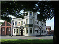
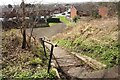
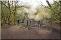
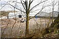
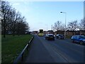
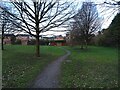
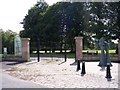
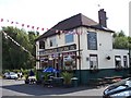
29 photos from this area
Area Information
Key information about the WN2 2HH including its size, population, and administrative classification.
- Area Type
- Postcode
- Area Size
- 1.5 hectares
- Population
- 1534
- Population Density
- 1789 people/km²
House Prices in WN2 2HH
39
Properties
£97,727
Average Sold Price
£65,000
Lowest Price
£180,000
Highest Price
Showing 39 properties
| Address | Type | Beds | Baths | Last Sale Price | Last Sale Date | |
|---|---|---|---|---|---|---|
| 45 Pennington Lane, Ince, WN2 2HH | Semi-detached | 3 | 1 | £125,000 | Jul 2023 | |
| 47 Pennington Lane, Ince, WN2 2HH | Semi-detached | 3 | 1 | £180,000 | Dec 2022 | |
| 54 Pennington Lane, Ince, WN2 2HH | house | - | - | £90,000 | Sep 2021 | |
| 25 Pennington Lane, Ince, WN2 2HH | house | 3 | - | £95,000 | Sep 2020 | |
| 10 Pennington Lane, Ince, WN2 2HH | Semi-detached | 3 | 2 | £100,000 | Sep 2019 | |
| 12 Pennington Lane, Ince, WN2 2HH | Semi-detached | 3 | - | £87,000 | Apr 2019 | |
| 32 Pennington Lane, Ince, WN2 2HH | Semi-detached | 3 | 1 | £85,000 | Jun 2018 | |
| 39 Pennington Lane, Ince, WN2 2HH | Semi-detached | 3 | 1 | £75,000 | Jun 2018 | |
| 24 Pennington Lane, Ince, WN2 2HH | Semi-detached | 3 | 1 | £65,000 | Feb 2017 | |
| 58 Pennington Lane, Ince, WN2 2HH | house | - | - | £79,950 | Jul 2015 |
Page 1 of 4
Energy Efficiency in WN2 2HH
Amenities
Schools
| Rank | School | Type | Entry gender | Ages |
|---|
Explore more schools in this area
Go to Schools tabDemographics
Household Size
Two person
most common
Accommodation Type
Houses
most common
Tenure
55
majority
Ethnic Group
White
most common
Religion
N/A
most common
Household Composition
N/A
most common
Age
47
median
Adults (30-64 years)
most common
Household Deprivation
N/A
with no deprivation
NS-SEC
16
in Lower managerial occupations
Explore more demographic insights in this area
Go to Demographics tabPlanning
Planning Constraints
- Flood RiskPremium
- Ramsar Wetland SitesPremium
- Area of Outstanding Natural BeautyPremium
- Protected Nature ReservePremium
- Protected WoodlandPremium