Area Overview for WN2 2DT
Photos of WN2 2DT
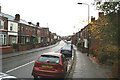
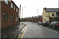
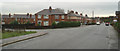
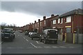
100 photos from this area
Area Information
Key information about the WN2 2DT including its size, population, and administrative classification.
- Area Type
- Postcode
- Area Size
- 1.2 hectares
- Population
- 1669
- Population Density
- 3074 people/km²
House Prices in WN2 2DT
39
Properties
£45,071
Average Sold Price
£13,000
Lowest Price
£120,000
Highest Price
Showing 39 properties
| Address | Type | Beds | Baths | Last Sale Price | Last Sale Date | |
|---|---|---|---|---|---|---|
| 51 Pinewood Crescent, Ince, WN2 2DT | Semi-detached | 3 | 1 | £120,000 | Mar 2023 | |
| 16 Pinewood Crescent, Ince, WN2 2DT | house | - | - | £52,000 | Apr 2019 | |
| 33 Pinewood Crescent, Ince, WN2 2DT | Semi-detached | 3 | 1 | £63,000 | Jul 2018 | |
| 45 Pinewood Crescent, Ince, WN2 2DT | house | - | - | £63,050 | Jul 2011 | |
| 47 Pinewood Crescent, Ince, WN2 2DT | Semi-detached | - | - | £61,500 | Nov 2004 | |
| 2 Pinewood Crescent, Ince, WN2 2DT | Semi-detached | 3 | 1 | £17,000 | Feb 2004 | |
| 49 Pinewood Crescent, Ince, WN2 2DT | Semi-detached | - | - | £21,655 | Jan 2003 | |
| 39 Pinewood Crescent, Ince, WN2 2DT | Semi-detached | 3 | 1 | £16,500 | Feb 1998 | |
| 14 Pinewood Crescent, Ince, WN2 2DT | Semi-detached | 3 | 1 | £13,000 | Oct 1997 | |
| 12 Pinewood Crescent, Ince, WN2 2DT | house | - | - | £23,000 | Feb 1996 |
Page 1 of 4
Energy Efficiency in WN2 2DT
Amenities
Schools
| Rank | School | Type | Entry gender | Ages |
|---|
Explore more schools in this area
Go to Schools tabDemographics
Household Size
Family (3-5 people)
most common
Accommodation Type
Houses
most common
Tenure
48
majority
Ethnic Group
White
most common
Religion
N/A
most common
Household Composition
N/A
most common
Age
47
median
Adults (30-64 years)
most common
Household Deprivation
N/A
with no deprivation
NS-SEC
16
in Lower managerial occupations
Explore more demographic insights in this area
Go to Demographics tabPlanning
Planning Constraints
- Flood RiskPremium
- Ramsar Wetland SitesPremium
- Area of Outstanding Natural BeautyPremium
- Protected Nature ReservePremium
- Protected WoodlandPremium