Area Overview for WN2 2BJ
Photos of WN2 2BJ
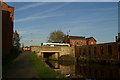
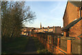
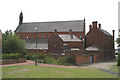
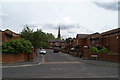
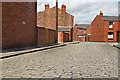

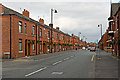

78 photos from this area
Area Information
Key information about the WN2 2BJ including its size, population, and administrative classification.
- Area Type
- Postcode
- Area Size
- 1.5 hectares
- Population
- 1620
- Population Density
- 1574 people/km²
House Prices in WN2 2BJ
52
Properties
£102,686
Average Sold Price
£10,000
Lowest Price
£165,000
Highest Price
Showing 52 properties
| Address | Type | Beds | Baths | Last Sale Price | Last Sale Date | |
|---|---|---|---|---|---|---|
| 77 Anderton Street, Ince, WN2 2BJ | Semi-detached | 3 | - | £103,000 | Sep 2025 | |
| 67 Anderton Street, Ince, WN2 2BJ | Terraced | 3 | 1 | £115,000 | Apr 2025 | |
| 65 Anderton Street, Ince, WN2 2BJ | Semi-detached | 3 | 2 | £130,000 | Mar 2025 | |
| 105 Anderton Street, Ince, WN2 2BJ | house | - | - | £145,000 | Feb 2025 | |
| 73 Anderton Street, Ince, WN2 2BJ | Terraced | 3 | 2 | £136,000 | Oct 2024 | |
| 79 Anderton Street, Ince, WN2 2BJ | Semi-detached | 3 | 1 | £165,000 | May 2024 | |
| 71 Anderton Street, Ince, WN2 2BJ | Terraced | 3 | 3 | £129,400 | Aug 2022 | |
| 75 Anderton Street, Ince, WN2 2BJ | Semi-detached | 4 | 3 | £140,000 | Jul 2022 | |
| 111 Anderton Street, Ince, WN2 2BJ | house | - | - | £95,000 | Feb 2021 | |
| 69 Anderton Street, Ince, WN2 2BJ | Semi-detached | 3 | 2 | £90,000 | Sep 2019 |
Page 1 of 6
Energy Efficiency in WN2 2BJ
Amenities
Schools
| Rank | School | Type | Entry gender | Ages |
|---|
Explore more schools in this area
Go to Schools tabDemographics
Household Size
Family (3-5 people)
most common
Accommodation Type
Houses
most common
Tenure
46
majority
Ethnic Group
White
most common
Religion
N/A
most common
Household Composition
N/A
most common
Age
47
median
Adults (30-64 years)
most common
Household Deprivation
N/A
with no deprivation
NS-SEC
14
in Lower managerial occupations
Explore more demographic insights in this area
Go to Demographics tabPlanning
Planning Constraints
- Flood RiskPremium
- Ramsar Wetland SitesPremium
- Area of Outstanding Natural BeautyPremium
- Protected Nature ReservePremium
- Protected WoodlandPremium