Area Overview for WN1 2SU
Photos of WN1 2SU
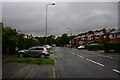
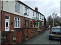
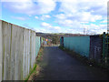
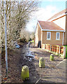
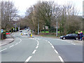
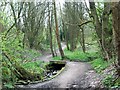
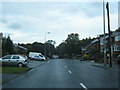
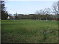
32 photos from this area
Area Information
Key information about the WN1 2SU including its size, population, and administrative classification.
- Area Type
- Postcode
- Area Size
- 1.0 hectares
- Population
- 1989
- Population Density
- 292 people/km²
House Prices in WN1 2SU
15
Properties
£163,082
Average Sold Price
£67,995
Lowest Price
£320,000
Highest Price
Showing 15 properties
| Address | Type | Beds | Baths | Last Sale Price | Last Sale Date | |
|---|---|---|---|---|---|---|
| 10 Ridge Avenue, Standish, WN1 2SU | Semi-detached | 2 | 1 | £100,000 | Jan 2024 | |
| 1 Ridge Avenue, Standish, WN1 2SU | Semi-detached | 3 | 1 | £320,000 | Oct 2022 | |
| 5 Ridge Avenue, Standish, WN1 2SU | Bungalow | - | - | £130,000 | Feb 2019 | |
| 13 Ridge Avenue, Standish, WN1 2SU | Semi-detached | 5 | - | £245,500 | Nov 2018 | |
| 9 Ridge Avenue, Standish, WN1 2SU | Bungalow | - | - | £151,000 | Jan 2018 | |
| 14 Ridge Avenue, Standish, WN1 2SU | Semi-detached | 4 | - | £209,405 | Sep 2015 | |
| 7 Ridge Avenue, Standish, WN1 2SU | Bungalow | - | - | £209,000 | Oct 2011 | |
| 6 Ridge Avenue, Standish, WN1 2SU | Bungalow | - | - | £138,000 | Oct 2010 | |
| 3 Ridge Avenue, Standish, WN1 2SU | Semi-detached | - | - | £145,000 | Nov 2004 | |
| 8 Ridge Avenue, Standish, WN1 2SU | Semi-detached | - | - | £78,000 | May 2002 |
Page 1 of 2
Energy Efficiency in WN1 2SU
Amenities
Schools
| Rank | School | Type | Entry gender | Ages |
|---|
Explore more schools in this area
Go to Schools tabDemographics
Household Size
Two person
most common
Accommodation Type
Houses
most common
Tenure
83
majority
Ethnic Group
White
most common
Religion
N/A
most common
Household Composition
N/A
most common
Age
47
median
Adults (30-64 years)
most common
Household Deprivation
N/A
with no deprivation
NS-SEC
45
in Lower managerial occupations
Explore more demographic insights in this area
Go to Demographics tabPlanning
Planning Constraints
- Flood RiskPremium
- Ramsar Wetland SitesPremium
- Area of Outstanding Natural BeautyPremium
- Protected Nature ReservePremium
- Protected WoodlandPremium