Area Overview for Winsford Swanlow Ward
Photos of Winsford Swanlow Ward
Area Information
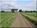
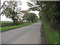
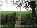
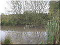
Winsford Swanlow Ward stands as a distinct electoral ward within the unitary authority of Cheshire West and Chester. This area covers approximately 13.2 square kilometres and sustains a population of 1,503 residents. You will find the ward anchored by key locations such as Swanlow Lane, situated at the postcode CW7 1JE. The geographic coordinates place the centre of activity around the British National Grid references SJ 662.0 630.0 and SJ 650.7 651.52. Living in Winsford Swanlow Ward means residing in a defined neighbourhood that balances rural and semi-rural characteristics. The land ownership and development patterns result in a low-density environment with roughly 114 people per square kilometre. You are locating homes within an area that extends from the coordinates 53.1688°N to the vicinity of 53.177594°N latitude. This specific ward functions as part of a larger structure connecting to settlements near SJ 650.7 651.52. The area offers a specific setting for those seeking a defined locality without the density of larger urban centres. Your daily life here involves navigating a landscape shaped by these precise geographic markers and administrative boundaries. The ward represents a clear choice for buyers looking for a settled community in North West England.
- Area Type
- District Borough Unitary Ward
- Area Size
- 13.2 km²
- Population
- 1503
- Population Density
- 114 people/km²
Demographics
The community profile of Winsford Swanlow Ward reveals a significant proportion of older residents. The median age across the ward sits at 70 years. This demographic skew indicates a population with distinct lifestyle needs compared to younger urban districts. Home ownership is exceptionally high within this boundary, with 71% of households owning their residence outright or with a mortgage. You are looking at an area where long-term settlement is the norm rather than a transient housing market. The data describes the total household composition and total accommodation types available within the ward. These figures reflect a settlement built for stability and family or retirement living rather than short-term rentals. Diversity data for predominant ethnicity and religion available in the total records does not specify a breakdown for this specific ward. You should plan your visit with the understanding that the social fabric here is rooted in deep local history. The age profile suggests a community focused on leisure, healthcare access, and maintenance services. When assessing quality of life, the high ownership rate signals a vested interest in the local infrastructure and planning. Every resident contributes to a static population figure that has stabilised around the 1,503 mark. This environment favours residents who value a quiet, established atmosphere over rapid demographic shifts.
Household Size
Accommodation Type
Tenure
Ethnic Group
Religion
Household Composition
Age
Household Deprivation
NS-SEC
Explore more demographic insights in this area
Go to Demographics tabPlanning
Planning Constraints
- Flood RiskPremium
- Ramsar Wetland SitesPremium
- Area of Outstanding Natural BeautyPremium
- Protected Nature ReservePremium
- Protected WoodlandPremium
- Crime RiskPremium