Area Overview for Winsford Dene Ward
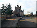
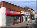
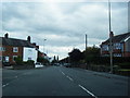
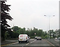
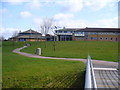
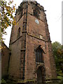
Photos of Winsford Dene Ward

Area Information
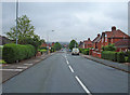
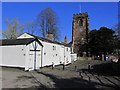
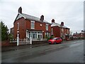
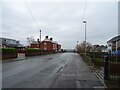
Winsford Dene Ward sits within the unitary authority of Cheshire West and Chester, forming part of the wider Winsford urban area alongside Northwich. This electoral ward occupies a compact space of just 1.5 km², placing it at the heart of established domestic life in the North West of England. Centred around the coordinates 53.18745740818282, -2.525630067600503, the area represents a slice of suburban existence defined by its proximity to larger industrial towns. The ward's geography suggests a focused community rather than a sprawling expansion, typical of historical urban evolution. Daily life here revolves around the rhythm of the surrounding urban fabric, where residents navigate a postcode environment that balances residential density with local access points. Prospective buyers should understand that living in Winsford Dene Ward means engaging with a mature settlement. The area is not a greenfield development but an existing ward integrated into the Cheshire landscape. Its distinction lies in its specific containment within the electoral map, creating a defined identity separate from the broader town while sharing amenities with the Winsford urban area. You will find yourself in a locality where the physical boundaries are clear and the sense of place is tied to its municipal classification. This neighbourhood offers a settled character, avoiding the speculation of new construction zones in favour of established residential patterns. Understanding the ward's specific coordinates and local governance structure provides a pragmatic view of your future environment, grounding your decision in the reality of the region's administrative layout.
- Area Type
- District Borough Unitary Ward
- Area Size
- 1.5 km²
- Population
- Not available
- Population Density
- Not available
Demographics
The community within Winsford Dene Ward displays a distinctly mature profile, with a median age of exactly 70 years. This figure indicates a population heavily weighted towards older residents, suggesting the area attracts retirees or families where the parents have largely raised their children and moved towards the later stages of life. While specific age range breakdowns are aggregated under the total in available records, the central tendency confirms a demographic shift away from younger households. This age profile often correlates with specific lifestyle needs, such as proximity to healthcare services and established retail centres, which residents would access daily. Household stability is evident through a home ownership rate of 67%. This high percentage suggests that most people in Winsford Dene Ward do not rent but have purchased their properties. Such a figure typically points to a market dominated by owner-occupiers rather than the young professional or landlord sectors common in other parts of the country. The stability of ownership often fosters a quiet, long-term community atmosphere. When you consider who lives here, you encounter a cohort invested in the ward's long-term value. This demographic reality shapes the local economy and social services, as the primary consumer base reflects the needs and spending power of the seventy-year-old median resident.
Household Size
Accommodation Type
Tenure
Ethnic Group
Religion
Household Composition
Age
Household Deprivation
NS-SEC
Explore more demographic insights in this area
Go to Demographics tabPlanning
Planning Constraints
- Flood RiskPremium
- Ramsar Wetland SitesPremium
- Area of Outstanding Natural BeautyPremium
- Protected Nature ReservePremium
- Protected WoodlandPremium
- Crime RiskPremium