Area Overview for Whittingham
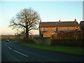
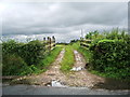
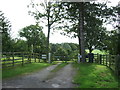
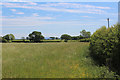
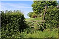
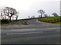
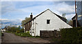
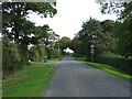
Photos of Whittingham

Area Information
Living in Whittingham offers a quiet existence within a defined civil parish covering 12.9 square kilometres in England. This area stands apart from busy urban centres due to its small footprint and settled character. You will find a neighbourhood where daily life moves at a deliberate pace, shaped by the physical boundaries of the parish itself. The environment is secure, with no Ramsey Wetland Sites, Areas of Outstanding Natural Beauty, protected nature reserves, or protected woodland imposing specific planning constraints on the landscape. Instead, you benefit from a straightforward settlement pattern that allows for established community structures. While the parish does not contain protected nature reserves, the lack of other environmental restrictions means that local development follows standard regulatory paths without the extra layers found in sensitive zones. The area functions as a distinct community unit rather than a sprawling town. Your days here are defined by proximity to local landmarks and familiar surroundings rather than long commutes within the parish limits. The 12.9 km² expanse is compact enough that essential amenities and natural features remain accessible on foot or a short drive. This layout supports a straightforward lifestyle where the boundaries of your daily world are clear and manageable. You do not need to navigate complex planning permissions to understand the land around you. The absence of major environmental designations simplifies the local context, allowing residents to focus on the immediate qualities of the parish. It is a place where the scope of the area directly influences the rhythm of your week, providing a contained and predictable setting for home life.
- Area Type
- Parish
- Area Size
- 12.9 km²
- Population
- Not available
- Population Density
- Not available
Demographics
The community in Whittingham reflects a significant shift in age demographics, with a median age of 70 years. This figure places the parish firmly within the profile of a mature retirement settlement rather than a young family hub. Age 70 sits at the crux of the population profile, indicating that the majority of residents have moved well past their working years. You will encounter a population where the typical household head is likely approaching or in their eighth decade of life. This age concentration creates a social environment accustomed to quiet neighbourhoods and established routines. The high age median suggests that services and recreation likely cater to an older demographic, shaping the commercial and social landscape of the parish. Home ownership stands at 86 per cent within Whittingham, confirming the area as a predominantly owner-occupied zone. This high rate of ownership signals financial stability among residents and a deep rootedness in the community. You are unlikely to encounter a large transient population of tenants renting properties on short-term contracts. Instead, most neighbours have settled permanently, creating a stable environment where local connections persist over decades. The data shows no breakdown by household composition or predominant ethnic group, but the high ownership rate implies a static, long-term community structure. Accommodation types reflect this tenure, with stock likely consisting of established private houses rather than modern rental blocks. Living here means dealing with a population that has invested heavily in their local surroundings, creating a sense of permanence that defines daily interactions for new arrivals.
Household Size
Accommodation Type
Tenure
Ethnic Group
Religion
Household Composition
Age
Household Deprivation
NS-SEC
Explore more demographic insights in this area
Go to Demographics tabPlanning
Planning Constraints
- Flood RiskPremium
- Ramsar Wetland SitesPremium
- Area of Outstanding Natural BeautyPremium
- Protected Nature ReservePremium
- Protected WoodlandPremium
- Crime RiskPremium