Area Overview for Whitewell & Stacksteads Ward
Photos of Whitewell & Stacksteads Ward
Area Information
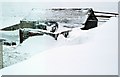
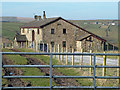
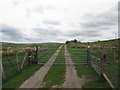
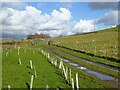
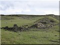
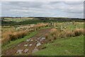
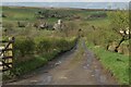
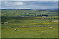
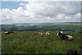
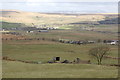
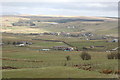
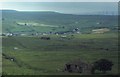
Living in Whitewell & Stacksteads Ward offers a quiet retreat within the Rossendale borough of Lancashire. This district spans 19.9 km² and was home to approximately 3,789 people according to the 2011 census. Stacksteads, the central village, sits between Bacup and Waterfoot along the River Irwell. You will find a small community that has evolved from its industrial past. During the 19th century, cotton mills defined the local economy before shifting to footwear manufacturing and quarrying. The Kimberley Club, established in 1897 for quarry workers, still operates today with its original gas lighting. Lee Quarry now provides a mountain bike trail, bridging the gap between the area's working heritage and modern leisure activities. The village of Stacksteads also features a railway history dating back to the 1870s on the Manchester and Bacup line. You are situated in the Rossendale and Darwen parliamentary constituency. St Andrews Church of England Schools often appear in the local landscape for formal education. The ward has appeared on screen as a filming location for the BBC1 police drama *Juliet Bravo* during the 1980s. Daily life here reflects a slower pace compared to the towns nearby. You move through an area where historical significance meets tranquil country settings. Homes in Whitewell & Stacksteads Ward appeal to those seeking stability away from urban congestion. The community focuses on local history and places that have stood the test of time.
- Area Type
- District Borough Unitary Ward
- Area Size
- 19.9 km²
- Population
- Not available
- Population Density
- Not available
Demographics
The community in Whitewell & Stacksteads Ward reflects an older demographic profile. The population shows a median age of 70 years. This indicates a resident base that is significantly older than the national average. You are likely to encounter many lifelong residents who have witnessed the transition from cotton manufacturing to modern leisure pursuits. The data confirms that this area is not a youth hub but a setting for mature living. Home ownership stands at 63% within the ward. This figure suggests a stable residential market where residents have long-term ties to their properties. You will find fewer landlord-owned properties compared to high-density rental zones. Most households and accommodation types are occupied by individuals who own their homes outright or have mortgages rather than renting short-term. The community composition remains relatively consistent over time. Deprivation is not highlighted in the available data, so you cannot definitively state how poverty levels impact local services. Instead, the high home ownership rate points to financial stability among the population. The area lacks recent census data on specific ethnic groups, religions, or detailed household compositions beyond the age and ownership metrics. You should focus on the stability offered by the 63% ownership rate rather than guessing at diversity trends that are not currently quantifiable. Living in Whitewell & Stacksteads Ward means joining an older, settled community.
Household Size
Accommodation Type
Tenure
Ethnic Group
Religion
Household Composition
Age
Household Deprivation
NS-SEC
Explore more demographic insights in this area
Go to Demographics tabPlanning
Planning Constraints
- Flood RiskPremium
- Ramsar Wetland SitesPremium
- Area of Outstanding Natural BeautyPremium
- Protected Nature ReservePremium
- Protected WoodlandPremium