Area Overview for Whalley Range Ward
Photos of Whalley Range Ward
Area Information
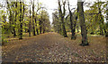
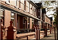
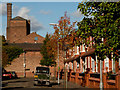
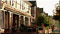
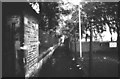
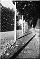
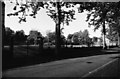
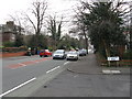
Whalley Range Ward is a compact district covering just 2.3 km² within the Greater Manchester borough. You will find this area serves as a specific urban ward rather than a sprawling suburb, concentrating residents and amenities into a defined space. The location sits firmly in England, offering a direct connection to broader city networks despite its small footprint. Living in Whalley Range Ward means navigating a environment where land is at a premium due to the limited square kilometreage available for development. The area defines itself through density rather than expansive green spaces, creating a community feel that is intense and immediate. Prospective buyers considering homes in Whalley Range Ward should understand the physical constraints of the locality. You are entering a space where every square metre counts, shaping the daily rhythm of life for those who call this ward home. The compact nature of the 2.3 km² jurisdiction means that infrastructure and services are tightly packed, requiring efficient local planning. This ward stands as a distinct unit within the larger administrative structure, offering a specific chapter of Manchester life that is self-contained yet connected. For anyone researching the region, Whalley Range Ward presents a straightforward, albeit small-scale, property opportunity with no room for error in spatial planning.
- Area Type
- District Borough Unitary Ward
- Area Size
- 2.3 km²
- Population
- Not available
- Population Density
- Not available
Demographics
Understanding the community in Whalley Range Ward requires looking closely at the age distribution of its residents. The data indicates a median age of 70 years, which marks this area as one of the most elderly populations in the country. Most common age groups reflect this older demographic profile, suggesting that the local culture is likely tailors itself to retired individuals or those seeking a quieter retirement. This age structure often influences local business offerings, public transport usage patterns, and even the pace of street life. Home ownership stands at 38% within this ward, meaning the vast majority of households rent their accommodation. This high rental rate suggests a transient population or a district where purchasing power has shifted towards tenancy. Household composition data supports the view of an older community, though specific breakdowns of family units versus single-person households remain generalised in the available figures. Ethnical diversity and religious affiliation are currently unquantified in the provided statistics, leaving the precise cultural fabric somewhat undefined in broad terms. For those assessing the social environment, the key fact remains that nearly two-thirds of residents do not own their homes, while the population centre rests well into the seventh decade of life.
Household Size
Accommodation Type
Tenure
Ethnic Group
Religion
Household Composition
Age
Household Deprivation
NS-SEC
Explore more demographic insights in this area
Go to Demographics tabPlanning
Planning Constraints
- Flood RiskPremium
- Ramsar Wetland SitesPremium
- Area of Outstanding Natural BeautyPremium
- Protected Nature ReservePremium
- Protected WoodlandPremium
- Crime RiskPremium