Area Overview for Westlinton
Photos of Westlinton


Area Information
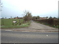
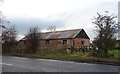
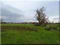
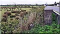
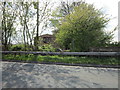
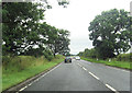
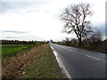
Westlinton is a small civil parish spanning 13.9 km² in rural England. The area functions as a quiet settlement rather than a busy town, offering a straightforward rural lifestyle for those seeking a slower pace. You are not surrounded by large urban centres, which defines the character of daily life here. The parish provides a sense of isolation balanced by the stability of established neighbourhoods. Living in Westlinton means accepting a remote location where proximity to major services is not a daily feature. Instead, your life revolves around the immediate landscape and the small community surrounding the parish boundary. This setting suits individuals who prioritise tranquillity over rapid transit to city hubs. Every household within these limits experiences a distinct separation from the wider world. The area does not offer the amenities of larger towns, so you must plan travel carefully for shopping or entertainment. Homes in Westlinton exist within a defined rural context where the priority is access to nature rather than urban convenience.
- Area Type
- Parish
- Area Size
- 13.9 km²
- Population
- Not available
- Population Density
- Not available
Demographics
The community in Westlinton has an exceptionally mature population profile, with a median age of 70 years old. This figure indicates that the majority of residents are senior citizens. You will find that the typical family unit with young children is likely absent from the parish council roll. The demographic data shows a residence dominated by older adults living in long-term establishments. Home ownership stands at 80%, which is a high proportion for any locality. This high rate suggests a stable environment built on prolonged local tenure rather than transient renting. Most households are likely single occupants or couples, given the age profile. The area reflects a settled pattern where residents have lived there for decades. You can expect a community where neighbours know one another well due to these long tenure periods. There is no indication of significant population inflows or migration turnover in this specific data set. The social fabric here depends on the established routines of a senior demographic. Understanding this age distribution is essential before considering homes in Westlinton.
Household Size
Accommodation Type
Tenure
Ethnic Group
Religion
Household Composition
Age
Household Deprivation
NS-SEC
Explore more demographic insights in this area
Go to Demographics tabPlanning
Planning Constraints
- Flood RiskPremium
- Ramsar Wetland SitesPremium
- Area of Outstanding Natural BeautyPremium
- Protected Nature ReservePremium
- Protected WoodlandPremium
- Crime RiskPremium