Area Overview for West Park Ward
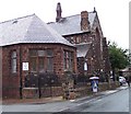
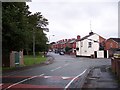
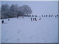
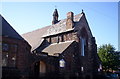
Photos of West Park Ward


Area Information
West Park Ward is a compact district within the City of Manchester, covering an area of just 2.4 square kilometres. This electoral ward sits in the North West region and offers a unique context for homebuyers seeking a specific neighbourhood identity. The location falls under the jurisdiction of Manchester City Council, locally governed through Manchester City Council's ward boundaries and divine representation. Living in West Park Ward means residing in a defined zone where residential life is closely tied to the municipal framework of Greater Manchester. Prospective buyers considering homes in West Park Ward are entering a specific political and geographical unit distinct from neighbouring districts. The ward represents a concentrated slice of the city where local governance directly impacts daily infrastructure and services. You may find yourself navigating a boundary that appears on official maps such as those provided by Manchester.gov.uk or cited in legislative records. The area is not isolated but forms part of the broader urban fabric identified in regional planning documents from sources like mapit.mysociety.org. While specific street-level details require council verification, the ward itself is a recognised administrative entity within England. Those researching schools near West Park Ward or amenities must look to the local authority's online directories for precise catchment information. The ward's small footprint means that local decisions have immediate effects on every resident. It is a place where the administrative definition aligns with the lived experience of the community. The area size suggests a focused living environment rather than a sprawling suburb. You can access historical and legal records confirming the ward's existence through legislation.gov.uk or local government archives. This grounding in fact allows you to understand exactly where you are investing. Whether you are analysing land use or considering the ward's role in regional politics, West Park Ward offers a clear, bounded location within the North West. The distinct identity of this ward provides a concrete starting point for your property search.
- Area Type
- District Borough Unitary Ward
- Area Size
- 2.4 km²
- Population
- Not available
- Population Density
- Not available
Demographics
The community within West Park Ward is defined by a clear age profile where the median age stands at exactly 70 years old. This statistical detail indicates that the most common age group consists of older residents, shaping the neighbourhood's daily rhythm and social needs. With a median age of 70, you are looking at an area where life expectancy and lifestyle choices cater to a senior demographic. Homeownership is prevalent, with 65 per cent of households owning their residences outright. This figure suggests a stable population where residents have long-term ties to the locality. The majority of accommodation in West Park Ward is owner-occupied, reflecting a traditional, settled community structure. The household composition data points to a total count that aligns with the older age profile, though specific numbers for singles versus families are not detailed in the current dataset. Ethnically and religiously, the ward reflects the total population mix relevant to the ward boundaries, yet specific percentages for predominant groups are not listed in the available research. You should be aware that 65 per cent ownership leaves 35 per cent of homes in other tenure types, likely comprising the younger demographic or those seeking different living arrangements. Deprivation levels are not quantified in the current data, so you must rely on other factors like proximity to services and transport links. Schools near West Park Ward will primarily serve the educational needs of this demographically older ward, potentially attracting students from outside the immediate boundaries. The high level of homeownership often means a quieter street life compared to areas with high rental turnover. When viewing homes in West Park Ward, expect to encounter long-standing residents who understand the local pulse. The 65 per cent statistic provides a solid baseline for understanding the financial stability of the area. Older residents often value leafy neighbourhoods, yet the specific character of West Park Ward remains rooted in these concrete demographic realities. The area's identity is inseparable from the fact that most people living here are middle-aged or elderly.
Household Size
Accommodation Type
Tenure
Ethnic Group
Religion
Household Composition
Age
Household Deprivation
NS-SEC
Explore more demographic insights in this area
Go to Demographics tabPlanning
Planning Constraints
- Flood RiskPremium
- Ramsar Wetland SitesPremium
- Area of Outstanding Natural BeautyPremium
- Protected Nature ReservePremium
- Protected WoodlandPremium