Area Overview for Weir
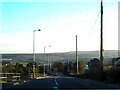
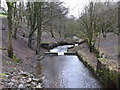
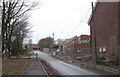
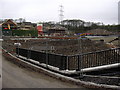
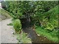
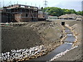
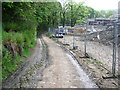
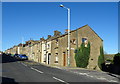
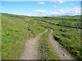
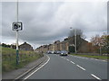
Photos of Weir


Area Information
Weir is a compact built-up area in England, covering 34.3 hectares. It is a town where daily life is shaped by practicality and proximity to essential services. The area’s population is predominantly older, with a median age of 70, suggesting a community that values stability and familiarity. Residents benefit from nearby retail options like Spar Bacup and Morrisons Newline, as well as rail connections to Todmorden and Burnley Manchester Road stations. Weir’s size makes it walkable, with amenities within practical reach. While it is not a sprawling city, its infrastructure supports a self-contained lifestyle. The high home ownership rate—83%—indicates a long-term presence of residents, many of whom have lived in the area for years. For those considering living in Weir, the combination of low crime risk, accessible transport, and a mature demographic offers a distinct contrast to busier urban environments. It is a place where convenience and quiet coexist, ideal for those seeking a balanced, community-oriented life.
- Area Type
- Built Up Area 250
- Area Size
- 34.3 hectares
- Population
- Not available
- Population Density
- Not available
Living in Weir offers access to a range of amenities within walking or short driving distance. Retail options include Spar Bacup, Morrisons Newline, and other local shops, ensuring everyday needs are met. The five nearby rail stations—Todmorden, Walsden, and Burnley Manchester Road—provide easy access to surrounding areas, while the Rawtenstall metro station connects to broader regional transport networks. Although the area lacks detailed data on parks or leisure facilities, the presence of multiple retail and transport hubs suggests a convenient lifestyle. Residents can shop, travel, and commute without needing to venture far, making daily routines efficient. The proximity to rail links also supports social or professional engagement beyond Weir, offering a balance between local convenience and regional connectivity.
Amenities
Schools
| Rank | A + A* % | School | Type | Entry gender | Ages |
|---|
Explore more schools in this area
Go to Schools tabDemographics
Weir’s population has a median age of 70, the highest in the dataset, indicating a community skewed towards older residents. This age profile suggests a demographic that may prioritize stability and established routines. Home ownership is exceptionally high at 83%, reflecting a strong preference for long-term residency over renting. The data does not specify household composition or accommodation types, but the high ownership rate implies a predominance of owner-occupied properties. The area’s diversity metrics are not quantified, but the absence of specific figures means no conclusions can be drawn about ethnic or religious composition. For those considering Weir, the age profile and ownership statistics highlight a mature, settled population with a focus on continuity. The lack of detailed diversity data means the community’s cultural or social makeup remains undefined in this analysis.
Household Size
Accommodation Type
Tenure
Ethnic Group
Religion
Household Composition
Age
Household Deprivation
NS-SEC
Explore more demographic insights in this area
Go to Demographics tabPlanning
Planning Constraints
- Crime RiskLocked