Area Overview for Warton Ward
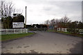
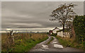
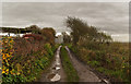
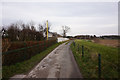
Photos of Warton Ward


Area Information
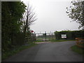
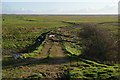
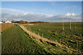
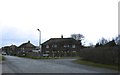
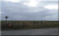
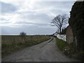
Warton Ward sits within a small geographical footprint of just 7.3 square kilometres, yet it supports a distinct way of life characterised by older homes and a mature population. This district represents a specific slice of England where residents navigate daily routines within a tightly defined boundary. Living here means moving into an environment where the scale of the area does not diminish the density of life. You will find a community rooted in history, with people who have called this exact stretch of land home for decades. The ward is defined by its age, not just in its properties, but in its people. When you consider homes in Warton Ward, you are entering a space where change happens slowly and familiarity remains high. The area offers a specific perspective on rural or semi-rural living, detached slightly from the faster pace of major urban centres. Your days will likely unfold in a setting where the surroundings dictate the rhythm of community interaction. There is a quiet practicality to life in this ward, where the necessities of daily living are managed within a compact space.
- Area Type
- District Borough Unitary Ward
- Area Size
- 7.3 km²
- Population
- Not available
- Population Density
- Not available
Demographics
The community profile of Warton Ward is dominated by older residents, reflecting a significant shift in the age structure of those living in the area. The median age here reaches 70 years, a figure that defines the social fabric of the ward. You will find that the most common age range corresponds with the total population, indicating a uniform spread of elderly households rather than a mix of young families and retirees. This demographic reality shapes how services operate and how neighbours interact within the ward. Large numbers of people in this age bracket typically rely on established routines and local support networks that have developed over a lifetime. The community here is not attracting young professionals or students in noticeable quantities, which influences the type of commerce and social events you might encounter. Living in Warton Ward requires an understanding of this older demographic, as social spaces and local amenities will cater to their specific needs and mobility levels. The population is concentrated in a way that creates a stable, if aging, community ethos.
Household Size
Accommodation Type
Tenure
Ethnic Group
Religion
Household Composition
Age
Household Deprivation
NS-SEC
Explore more demographic insights in this area
Go to Demographics tabPlanning
Planning Constraints
- Flood RiskPremium
- Ramsar Wetland SitesPremium
- Area of Outstanding Natural BeautyPremium
- Protected Nature ReservePremium
- Protected WoodlandPremium
- Crime RiskPremium