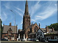
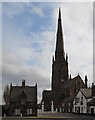
Area Overview for Warrington
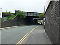
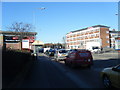
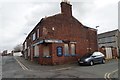
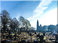
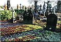
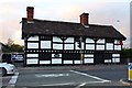
Photos of Warrington


Area Information
Living in Warrington offers a distinct experience within a built-up area defined by its manageable scale and community focus. The locality covers 47.7 square kilometres, providing enough space for residential communities without the density of larger cities. You will find that the population stands at 36,419 people, creating a neighbourhood size that often facilitates a sense of familiarity among residents. This figure indicates a community that is settled and established rather than a rapidly expanding new-build estate. The character of Warrington is rooted in this stable population count, which supports a range of local services without the congestion seen in metropolitan centres. Residents here can expect daily life to revolve around practical accessibility and neighbourhood cohesion. The area functions as a self-contained town where you can address most of your needs locally. When considering homes in Warrington, you are looking at a location where the built environment supports a steady pace of living. The area's identity is formed by its residents and its specific geographic footprint. You will find that the distinction of this locality lies in its balance between urban amenities and a quieter residential setting. This environment suits those who value a home surrounded by a defined community rather than a sprawling conurbation.
- Area Type
- District/Borough
- Area Size
- 47.7 km²
- Population
- 36419
- Population Density
- 763 people/km²
Demographics
The demographic profile of Warrington reveals a settled community with clear patterns in age and ownership. The median age in the area is 70, indicating a population skewed significantly towards older adults. This high median age suggests that many families with young children may have moved on, leaving behind a cohort with long-standing ties to the neighbourhood. Home ownership stands at 68%, which is a strong indicator of stability within the housing stock. A majority of the population owns their property outright or with a mortgage, implying that residents have been settled for extended periods. This high rate of ownership often correlates with deeper community involvement and a slower turnover of residents. You will find that household compositions likely reflect this older demographic, with a higher proportion of single-person households or couples without children. The data does not specify ethnic groups or religious affiliations, but the demographic weight heavily favours an older population structure. For someone looking at living in Warrington, this means you are entering a market dominated by established residents rather than new families or young professionals. The community feels mature, with a low median age driving a need for healthcare and leisure facilities suitable for seniors rather than youth-focused centres.
Household Size
Accommodation Type
Tenure
Ethnic Group
Religion
Household Composition
Age
Household Deprivation
NS-SEC
Explore more demographic insights in this area
Go to Demographics tabPlanning
Planning Constraints
- Crime RiskLocked