Area Overview for Wardley
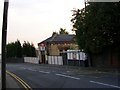
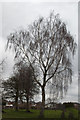
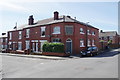
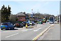
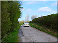
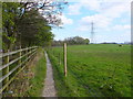
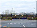
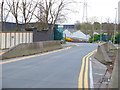
Photos of Wardley
Area Information
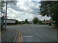
Wardley is a built-up area in England covering 47.4 hectares, positioned as a compact yet functional community. The area’s median age of 70 suggests a population skewed toward older residents, which shapes its character and daily life. Living in Wardley means proximity to a mix of retail, transport, and educational facilities, making it practical for those prioritising accessibility over sprawling landscapes. The area’s 71% home ownership rate indicates a stable residential base, with many residents likely to have lived in the area for extended periods. Wardley’s compact size means amenities are within walking or short driving distance, though the high median age may influence the pace of life. The presence of two primary schools and multiple transport links, including rail and metro stations, adds to its appeal for families and commuters. While the area’s age profile and infrastructure suggest a mature, settled community, its proximity to Manchester’s broader networks offers opportunities for those seeking a balance between local convenience and urban connectivity.
- Area Type
- Built Up Area 250
- Area Size
- 47.4 hectares
- Population
- Not available
- Population Density
- Not available
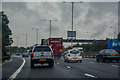
Wardley’s lifestyle is shaped by its proximity to a variety of retail, transport, and leisure facilities. Local shops include major supermarkets such as Tesco Manchester, Asda Swinton, and Morrisons Swinton, ensuring easy access to groceries and everyday essentials. The area’s transport links, including rail, metro, and bus services, connect residents to broader networks, enabling quick travel to nearby towns or Manchester itself. The presence of Manchester City Airport adds convenience for frequent travellers. While the data does not specify parks or recreational spaces, the density of amenities suggests a focus on practicality over expansive green areas. For residents, this means a lifestyle prioritising accessibility and efficiency, with minimal need to travel far for shopping, work, or travel. The mix of retail and transport options creates a self-contained environment, though those seeking more natural or leisure-focused amenities may need to look beyond the immediate vicinity.
Amenities
Schools
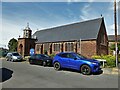
Residents of Wardley have access to two primary schools: St Ambrose Barlow RC High School, which holds a ‘good’ Ofsted rating, and Wardley High School. Both institutions serve the local community, providing education for younger families in the area. The presence of two primary schools suggests a focus on early education, though secondary school options are not listed in the data, which may require residents to travel further for secondary education. The ‘good’ rating at St Ambrose Barlow RC High School indicates a school that meets national standards in teaching and student outcomes, offering reassurance for parents prioritising quality education. However, the absence of specific data on school capacity, pupil numbers, or additional facilities means further details about the educational environment remain unclear. For families, the availability of primary schools within the area is a practical advantage, though secondary schooling may involve commuting to nearby towns.
| Rank | School | Type | Entry gender | Ages |
|---|
Explore more schools in this area
Go to Schools tabDemographics
Wardley’s population has a median age of 70, the highest recorded in the dataset, indicating a community predominantly composed of older residents. This age profile suggests a demographic focused on stability rather than growth, with implications for local services and social dynamics. The home ownership rate of 71% underscores that most residents live in their own homes, which may reflect long-term residency and a preference for established housing. However, the data does not specify household composition or diversity, so broader conclusions about family structures or cultural mix are not possible. The lack of detailed information on accommodation types or ethnic groups means the area’s social fabric remains partially obscured. For prospective buyers, the high median age may indicate a quieter, less transient environment, though it also raises questions about the availability of age-appropriate housing or healthcare facilities. The data does not address deprivation levels, but the combination of high home ownership and older demographics could suggest a community with lower immediate demand for new developments.
Household Size
Accommodation Type
Tenure
Ethnic Group
Religion
Household Composition
Age
Household Deprivation
NS-SEC
Explore more demographic insights in this area
Go to Demographics tabPlanning
Planning Constraints
- Crime RiskPremium