Area Overview for Walney Island Ward

Rusty accommodation ship. in Walney Island Ward
Road from the Port of Barrow towards the Town Centre in Walney Island Ward
Building, Port of Barrow in Walney Island Ward
View down the Walney Channel - Barrow-in-Furness in Walney Island Ward
BAE Systems - diesel oil tanks in Walney Island Ward
Walney Channel and Jetty, Barrow-in-Furness in Walney Island Ward
Walney Channel seen from Harding Rise, Barrow-in-Furness in Walney Island Ward
Steps to Harding Rise, Barrow-in-Furness in Walney Island Ward
A pill box by Walney Channel, Barrow-in-Furness in Walney Island Ward
Walney Channel, Barrow-in-Furness in Walney Island Ward
A jetty on Walney Channel, Barrow-in-Furness in Walney Island Ward
The path between Walney Channel and Harding Rise, Barrow-in-Furness in Walney Island Ward
31 photos from this area

Area Information

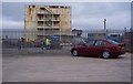
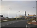
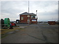
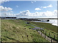
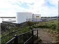
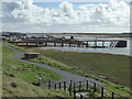
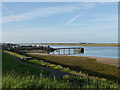
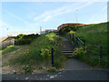
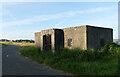
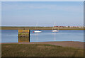
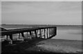
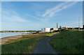
Walney Island Ward occupies a distinctive position off the coast of Barrow-in-Furness in Cumbria. This electoral ward encompasses Walney Island, a tidal landmass covering an area of 38.3 km². You are connecting to a community of 8,831 residents across this historic space. The island has been part of the Furness Peninsula since the last glacial period formed the land at the mouth of the River Duddon. A bascule bridge known as the Jubilee Bridge, which opened in 1908, provides the primary link to the mainland. Daily life here balances coastal heritage with modern connectivity. The ward evolved from a historical subdivision of Hawcoat before becoming part of Barrow-in-Furness County Borough in 1872. You are looking at a neighbourhood where Neolithic evidence in the dunes coexists with industrial history dating back to the 19th-century docks. The atmosphere is shaped by the island's gradual isolation and its strong ties to shipbuilding. Residents live in a setting that includes protected nature reserves and Ramsar wetland sites. This ward does not contain Areas of Outstanding Natural Beauty, but it retains significant planning constraints due to its ecological value. You are considering homes in an area where the past defines the present, from the abandoned docks in Vickerstown to the working coastline.

Area Type
District Borough Unitary Ward
Area Size
38.3 km²
Population
8831
Population Density
230 people/km²

Demographics

The community structure in Walney Island Ward tells a clear story through its official statistics. The median age across the ward reaches 70 years. By comparison, the national median age in England is significantly lower at 40. This demographic profile indicates a community dominated by older residents. Almost three-quarters of local people are 65 years of age or over. Home ownership stands at 79% within the ward. This high rate suggests that most accommodation is held by those who live there permanently rather than by tenants. You are entering a market where stability is the norm. The data does not break down accommodation types or predominant ethnic groups in the provided figures. Instead, the population density gives you a clearer picture of living space. The area supports 230 people per square kilometre. This density is moderate for an island setting and allows for quiet neighbourhoods. You are looking at a location where community bonds are likely strong due to shared age and long-term residence. The household composition data is summarised as total but supports the picture of established families and individuals living in owner-occupied properties.

Household Size

total
most common

Accommodation Type

total
most common

Tenure

79
majority

Ethnic Group

total
most common

Religion

total
most common

Household Composition

total
most common

Age

70
median
Age: Total
most common

Household Deprivation

N/A
with no deprivation

NS-SEC

28
in Lower managerial occupations

Explore more demographic insights in this area

Go to Demographics tab

Planning

Planning Constraints

  • Flood Risk
    Premium
  • Ramsar Wetland Sites
    Premium
  • Area of Outstanding Natural Beauty
    Premium
  • Protected Nature Reserve
    Premium
  • Protected Woodland
    Premium
  • Crime Risk
    Premium

Explore more planning insights in this area

Open Planning map

Frequently Asked Questions

Who typically lives in Walney Island Ward and what is the community like?
The median age in Walney Island Ward is 70 years. Nearly 80% of those living here own their homes. You are looking at a community where three-quarters of residents are aged 65 or over. This creates a stable environment with many long-term owners rather than transient tenants. The ward houses 8,831 people across 38.3 km² of tidal land.
How are digital connectivity and broadband services for working from home?
Fixed broadband quality in Walney Island Ward scores 74 out of 100. This is a good rating, indicating reliable internet speeds. You can expect fair to good performance for remote working. However, mobile network coverage is not detailed in the available data. You are getting solid fixed-line connections for your office needs.
Is Walney Island Ward safe and secure to live in?
Crime levels are low, with a safety score of 75 out of 100, placing the ward in a Pass category. You are living in an area with below-average crime rates. The main environmental concern is flood risk, not crime. Flood assessments show a Critical level with a score of 75.13 meaning high risk coverage. You must account for potential flooding when choosing a property.
How do I get to London from homes in Walney Island Ward?
There is no direct rapid train to London from the island. You must use Barrow-in-Furness station for connections. The journey to London takes approximately four hours via Avanti West Coast or TransPennine Express services. The Jubilee Bridge opened in 1908 remains the primary road link to the mainland for your daily commute.

We use cookies to provide you with the best experience. By continuing, you agree to our Cookie Policy .