Area Overview for Walkden South Ward
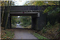
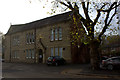
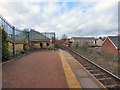
Photos of Walkden South Ward


Area Information
Living in Walkden South Ward offers a specific type of residential experience within England. This district borough unitary ward spans just 3.8 km², creating a relatively compact sphere for daily activities. You will find a community defined by its senior populace rather than young families or students. The area's distinct character stems from the fact that 69% of residents own their home, suggesting a long-term settlement pattern rather than a transient rental market. Daily life here revolves around established neighbourhoods where stability is common. Prospective buyers should note that the physical footprint of this ward is small. You cover less ground to reach local amenities compared to wider boroughs. The environment is free from major planning constraints that might slow down development or alter landscapes. There are no Ramsar wetland sites, areas of outstanding natural beauty, or protected nature reserves within these boundaries. You will not encounter restrictions related to protected woodland either. This clarity on land status means the built environment dominates the landscape. The area functions as a self-contained residential zone where you can manage your daily needs without travelling far outside the 3.8 km² limit.
- Area Type
- District Borough Unitary Ward
- Area Size
- 3.8 km²
- Population
- Not available
- Population Density
- Not available
Demographics
The community profile of Walkden South Ward is heavily skewed towards older residents. You will encounter a median age of 70 years. This demographic reality defines the social rhythm of the ward. The most common age range falls entirely within the senior bracket, indicating that fewer young children or young adults live here. With a median age at 70, you are looking at an area where retirement living is the norm. Home ownership stands at a solid 69% in this ward. This figure reinforces the idea of a settled, older population. The remaining 31% consist of renters or shared homeowners, likely representing those age groups who did not accumulate property equity earlier in life. Household composition data in the available records does not provide specific breakdowns for mixed families or single-person households. Instead, the totals reflect a population built around older demographics. Accommodation type statistics likewise remain at the total level, offering no granular view of apartment blocks versus detached homes. You should expect a neighbourhood where neighbours understand the rhythms of pensioner life. Services must be accessible within 3.8 km² because mobility may be a factor for 70-year-old residents. The lack of data on specific household types suggests a homogeneity in lifestyle. You are buying into an area where the primary demographic is clearly defined by age rather than variety.
Household Size
Accommodation Type
Tenure
Ethnic Group
Religion
Household Composition
Age
Household Deprivation
NS-SEC
Explore more demographic insights in this area
Go to Demographics tabPlanning
Planning Constraints
- Flood RiskPremium
- Ramsar Wetland SitesPremium
- Area of Outstanding Natural BeautyPremium
- Protected Nature ReservePremium
- Protected WoodlandPremium
- Crime RiskPremium