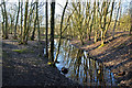
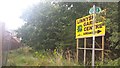
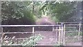
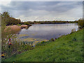
Area Overview for Walkden North Ward
Photos of Walkden North Ward
Area Information
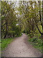
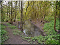
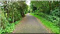
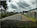
Walkden North Ward occupies a distinct footprint within the Greater Manchester landscape, covering exactly 4.5 square kilometres. This relatively compact neighbourhood holds a population of 1,746 residents, creating a close-knit environment with a density of 390 people per square kilometre. Living in Walkden North Ward means navigating a community where space is valued but not abundant. The ward functions as a defined borough unitary area, providing clear administrative boundaries for local governance and council services. Prospective buyers looking at homes in Walkden North Ward should understand they are entering a specific micro-locality rather than a sprawling urban zone. The relatively small footprint ensures that distance between daily essentials remains manageable for most residents. However, the density figure indicates that development has reached a level where every metre of land is utilised for habitation or green space. This concentration of people within a limited geographic area shapes the rhythm of daily life. You will find a setting that balances residential privacy with proximity to neighbours. The area serves as a self-contained district within the larger Borough of Wigan, offering a slice of life that is distinctly localised. Understanding this geographic scale helps set expectations for noise levels, community interaction, and property values.
- Area Type
- District Borough Unitary Ward
- Area Size
- 4.5 km²
- Population
- 1746
- Population Density
- 390 people/km²
Demographics
The community profile of Walkden North Ward is defined by a notably older population. Data indicates a median age of 70 years across the ward. This demographic reality shapes the character of the neighbourhood significantly. The most common age range listed is marked as 'Total', reflecting the overarching nature of the statistical summary for this specific postcode area analysis. Consequently, the residential environment is likely populated largely by retirees or older adults seeking a calm setting. Home ownership stands at 51 per cent within the ward. This figure suggests a balanced split between owners and those living in rented accommodation or social housing. Accommodation types are recorded as a total figure without a breakdown of specific housing styles. Predator ethnic group and religion data are not specified in the current dataset, so specific claims about cultural diversity or religious makeup cannot be made beyond the observed age profile. The absence of detailed ethnic or religious descriptors means the community appears to be defined primarily by generational trends rather than overt cultural segmentation based on available records. Deprivation factors are not quantified in the provided details, so quality of life assessments must rely on the positive demographic indicator of home ownership. For families considering schools near Walkden North Ward, the age skew suggests a low demand for primary education locally, potentially meaning secondary schools would draw pupils from a wider radius.
Household Size
Accommodation Type
Tenure
Ethnic Group
Religion
Household Composition
Age
Household Deprivation
NS-SEC
Explore more demographic insights in this area
Go to Demographics tabPlanning
Planning Constraints
- Flood RiskPremium
- Ramsar Wetland SitesPremium
- Area of Outstanding Natural BeautyPremium
- Protected Nature ReservePremium
- Protected WoodlandPremium
- Crime RiskPremium