Area Overview for WA9 4PE
Photos of WA9 4PE
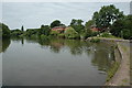

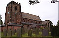
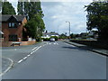
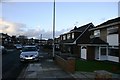

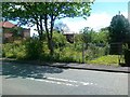
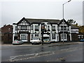


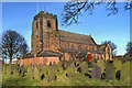
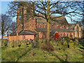
19 photos from this area
Area Information
Key information about the WA9 4PE including its size, population, and administrative classification.
- Area Type
- Postcode
- Area Size
- 1.3 hectares
- Population
- 1444
- Population Density
- 5676 people/km²
House Prices in WA9 4PE
40
Properties
£115,875
Average Sold Price
£34,500
Lowest Price
£215,000
Highest Price
Showing 40 properties
| Address | Type | Beds | Baths | Last Sale Price | Last Sale Date | |
|---|---|---|---|---|---|---|
| 20 Porlock Avenue, Sutton Leach, St Helens, WA9 4PE | Bungalow | 2 | 1 | £179,950 | Jul 2025 | |
| 36 Porlock Avenue, Sutton Leach, St Helens, WA9 4PE | Semi-detached | 4 | 2 | £215,000 | Mar 2025 | |
| 32 Porlock Avenue, Sutton Leach, St Helens, WA9 4PE | Semi-detached | 3 | 1 | £180,200 | Jan 2025 | |
| 9 Porlock Avenue, Sutton Leach, St Helens, WA9 4PE | Bungalow | 2 | 1 | £137,500 | Dec 2022 | |
| 46 Porlock Avenue, Sutton Leach, St Helens, WA9 4PE | Retail | 3 | 1 | £160,000 | Oct 2022 | |
| 44 Porlock Avenue, Sutton Leach, St Helens, WA9 4PE | house | 3 | 1 | £185,000 | Sep 2022 | |
| 31 Porlock Avenue, Sutton Leach, St Helens, WA9 4PE | Semi-detached | 3 | - | £170,000 | Sep 2021 | |
| 2 Porlock Avenue, Sutton Leach, St Helens, WA9 4PE | Semi-detached | 2 | 2 | £148,000 | Aug 2020 | |
| 18 Porlock Avenue, Sutton Leach, St Helens, WA9 4PE | Bungalow | 2 | 1 | £108,500 | Jan 2020 | |
| 25 Porlock Avenue, Sutton Leach, St Helens, WA9 4PE | Semi-detached | 3 | 2 | £154,950 | Mar 2019 |
Page 1 of 4
Energy Efficiency in WA9 4PE
Amenities
Schools
| Rank | School | Type | Entry gender | Ages |
|---|
Explore more schools in this area
Go to Schools tabDemographics
Household Size
Two person
most common
Accommodation Type
Houses
most common
Tenure
88
majority
Ethnic Group
White
most common
Religion
N/A
most common
Household Composition
N/A
most common
Age
47
median
Adults (30-64 years)
most common
Household Deprivation
N/A
with no deprivation
NS-SEC
25
in Lower managerial occupations
Explore more demographic insights in this area
Go to Demographics tabPlanning
Planning Constraints
- Flood RiskPremium
- Ramsar Wetland SitesPremium
- Area of Outstanding Natural BeautyPremium
- Protected Nature ReservePremium
- Protected WoodlandPremium