Area Overview for WA9 4BA
Photos of WA9 4BA

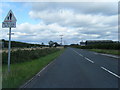

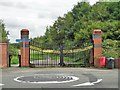
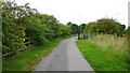
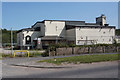
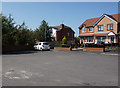
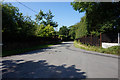

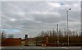
46 photos from this area
Area Information
Key information about the WA9 4BA including its size, population, and administrative classification.
- Area Type
- Postcode
- Area Size
- 6552 m²
- Population
- 1877
- Population Density
- 1473 people/km²
House Prices in WA9 4BA
20
Properties
£88,433
Average Sold Price
£27,600
Lowest Price
£140,000
Highest Price
Showing 20 properties
| Address | Type | Beds | Baths | Last Sale Price | Last Sale Date | |
|---|---|---|---|---|---|---|
| 238 Jubits Lane, Sutton Manor, St Helens, WA9 4BA | Terraced | 3 | 1 | £62,000 | Apr 2020 | |
| 204 Jubits Lane, Sutton Manor, St Helens, WA9 4BA | Semi-detached | 3 | 1 | £128,000 | Sep 2019 | |
| 200A Jubits Lane, Sutton Manor, St Helens, WA9 4BA | Flat | 3 | 1 | £140,000 | Feb 2019 | |
| 214 Jubits Lane, Sutton Manor, St Helens, WA9 4BA | Terraced | 2 | 1 | £51,299 | Jul 2017 | |
| 220 Jubits Lane, Sutton Manor, St Helens, WA9 4BA | house | - | - | £27,600 | Feb 2017 | |
| 228 Jubits Lane, Sutton Manor, St Helens, WA9 4BA | house | - | - | £50,000 | Jan 2007 | |
| 222 Jubits Lane, Sutton Manor, St Helens, WA9 4BA | house | - | - | £131,000 | Nov 2006 | |
| 202 Jubits Lane, Sutton Manor, St Helens, WA9 4BA | house | - | - | £128,000 | Sep 2006 | |
| 234 Jubits Lane, Sutton Manor, St Helens, WA9 4BA | house | 3 | - | £78,000 | Feb 2005 | |
| 210 Jubits Lane, Sutton Manor, St Helens, WA9 4BA | Detached | 3 | 2 | - | - |
Page 1 of 2
Energy Efficiency in WA9 4BA
Amenities
Schools
| Rank | School | Type | Entry gender | Ages |
|---|
Explore more schools in this area
Go to Schools tabDemographics
Household Size
Family (3-5 people)
most common
Accommodation Type
Houses
most common
Tenure
48
majority
Ethnic Group
White
most common
Religion
N/A
most common
Household Composition
N/A
most common
Age
47
median
Adults (30-64 years)
most common
Household Deprivation
N/A
with no deprivation
NS-SEC
19
in Lower managerial occupations
Explore more demographic insights in this area
Go to Demographics tabPlanning
Planning Constraints
- Flood RiskPremium
- Ramsar Wetland SitesPremium
- Area of Outstanding Natural BeautyPremium
- Protected Nature ReservePremium
- Protected WoodlandPremium