Area Overview for WA9 3LE
Photos of WA9 3LE
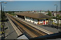
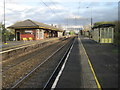
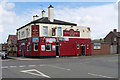
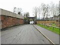
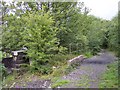
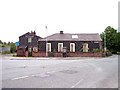
37 photos from this area
Area Information
Key information about the WA9 3LE including its size, population, and administrative classification.
- Area Type
- Postcode
- Area Size
- 5963 m²
- Population
- 1660
- Population Density
- 1848 people/km²
House Prices in WA9 3LE
26
Properties
£68,841
Average Sold Price
£19,500
Lowest Price
£115,930
Highest Price
Showing 26 properties
| Address | Type | Beds | Baths | Last Sale Price | Last Sale Date | |
|---|---|---|---|---|---|---|
| 119 Herbert Street, St Helens, WA9 3LE | Terraced | 3 | 1 | £90,000 | Apr 2025 | |
| 98 Herbert Street, St Helens, WA9 3LE | Semi-detached | 1 | 1 | £70,000 | Jan 2023 | |
| 116 Herbert Street, St Helens, WA9 3LE | house | - | - | £61,000 | Oct 2022 | |
| 104 Herbert Street, St Helens, WA9 3LE | house | - | - | £83,500 | Mar 2021 | |
| 121 Herbert Street, St Helens, WA9 3LE | Terraced | 3 | 1 | £115,930 | Jul 2019 | |
| 131 Herbert Street, St Helens, WA9 3LE | Terraced | 3 | 1 | £65,000 | May 2018 | |
| 135 Herbert Street, St Helens, WA9 3LE | Terraced | 3 | 1 | £65,000 | Dec 2016 | |
| 129 Herbert Street, St Helens, WA9 3LE | Terraced | 3 | - | £55,000 | May 2016 | |
| 114 Herbert Street, St Helens, WA9 3LE | Bungalow | 3 | 1 | £70,000 | Mar 2015 | |
| 123 Herbert Street, St Helens, WA9 3LE | Terraced | 3 | 1 | £74,000 | Dec 2013 |
Page 1 of 3
Energy Efficiency in WA9 3LE
Amenities
Schools
| Rank | School | Type | Entry gender | Ages |
|---|
Explore more schools in this area
Go to Schools tabDemographics
Household Size
Two person
most common
Accommodation Type
Houses
most common
Tenure
62
majority
Ethnic Group
White
most common
Religion
N/A
most common
Household Composition
N/A
most common
Age
47
median
Adults (30-64 years)
most common
Household Deprivation
N/A
with no deprivation
NS-SEC
27
in Lower managerial occupations
Explore more demographic insights in this area
Go to Demographics tabPlanning
Planning Constraints
- Flood RiskPremium
- Ramsar Wetland SitesPremium
- Area of Outstanding Natural BeautyPremium
- Protected Nature ReservePremium
- Protected WoodlandPremium