Area Overview for WA9 3DU
Photos of WA9 3DU


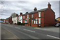

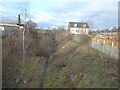
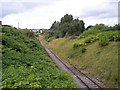
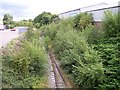

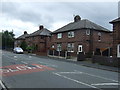
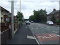
17 photos from this area
Area Information
Key information about the WA9 3DU including its size, population, and administrative classification.
- Area Type
- Postcode
- Area Size
- 1.6 hectares
- Population
- 1771
- Population Density
- 1501 people/km²
House Prices in WA9 3DU
25
Properties
£64,667
Average Sold Price
£14,000
Lowest Price
£115,000
Highest Price
Showing 25 properties
| Address | Type | Beds | Baths | Last Sale Price | Last Sale Date | |
|---|---|---|---|---|---|---|
| 203 Sutton Road, St Helens, WA9 3DU | Terraced | 3 | 1 | £115,000 | Jul 2024 | |
| 173 Sutton Road, St Helens, WA9 3DU | Terraced | 2 | 1 | £110,000 | Jun 2023 | |
| 183 Sutton Road, St Helens, WA9 3DU | Terraced | 3 | 1 | £75,000 | Aug 2022 | |
| 193 Sutton Road, St Helens, WA9 3DU | Terraced | 2 | 1 | £80,000 | Jun 2022 | |
| 195 Sutton Road, St Helens, WA9 3DU | house | - | - | £105,000 | Jun 2021 | |
| 185 Sutton Road, St Helens, WA9 3DU | Terraced | 2 | - | £85,000 | Dec 2020 | |
| 161 Sutton Road, St Helens, WA9 3DU | house | - | - | £73,000 | Oct 2019 | |
| 159 Sutton Road, St Helens, WA9 3DU | Terraced | 2 | - | £57,000 | Dec 2018 | |
| 199 Sutton Road, St Helens, WA9 3DU | Detached | 2 | 1 | £25,000 | Mar 2016 | |
| 167 Sutton Road, St Helens, WA9 3DU | Terraced | - | - | £83,500 | Nov 2006 |
Page 1 of 3
Energy Efficiency in WA9 3DU
Amenities
Schools
| Rank | School | Type | Entry gender | Ages |
|---|
Explore more schools in this area
Go to Schools tabDemographics
Household Size
Two person
most common
Accommodation Type
Houses
most common
Tenure
63
majority
Ethnic Group
White
most common
Religion
N/A
most common
Household Composition
N/A
most common
Age
47
median
Adults (30-64 years)
most common
Household Deprivation
N/A
with no deprivation
NS-SEC
20
in Lower managerial occupations
Explore more demographic insights in this area
Go to Demographics tabPlanning
Planning Constraints
- Flood RiskPremium
- Ramsar Wetland SitesPremium
- Area of Outstanding Natural BeautyPremium
- Protected Nature ReservePremium
- Protected WoodlandPremium