Area Overview for WA9 2NB
Photos of WA9 2NB

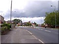
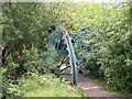
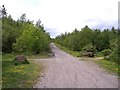
21 photos from this area
Area Information
Key information about the WA9 2NB including its size, population, and administrative classification.
- Area Type
- Postcode
- Area Size
- 7.7 hectares
- Population
- 2163
- Population Density
- 2088 people/km²
House Prices in WA9 2NB
29
Properties
£111,700
Average Sold Price
£50,000
Lowest Price
£200,000
Highest Price
Showing 29 properties
| Address | Type | Beds | Baths | Last Sale Price | Last Sale Date | |
|---|---|---|---|---|---|---|
| 486 Fleet Lane, St Helens, WA9 2NB | house | - | - | £135,000 | Jul 2025 | |
| 470 Fleet Lane, St Helens, WA9 2NB | house | - | - | £50,000 | Apr 2024 | |
| 468 Fleet Lane, St Helens, WA9 2NB | Terraced | 2 | 1 | £55,000 | May 2023 | |
| 466 Fleet Lane, St Helens, WA9 2NB | house | 3 | 1 | £200,000 | Feb 2023 | |
| 484 Fleet Lane, St Helens, WA9 2NB | Detached | 3 | 1 | £132,500 | Oct 2022 | |
| 512 Fleet Lane, St Helens, WA9 2NB | house | - | - | £60,000 | Apr 2010 | |
| 522 Fleet Lane, St Helens, WA9 2NB | house | - | - | £200,000 | Aug 2009 | |
| 508 Fleet Lane, St Helens, WA9 2NB | Semi-detached | - | - | £120,000 | May 2008 | |
| 480 Fleet Lane, St Helens, WA9 2NB | house | - | - | £107,000 | Jul 2006 | |
| 506 Fleet Lane, St Helens, WA9 2NB | Semi-detached | - | - | £57,500 | Feb 2003 |
Page 1 of 3
Energy Efficiency in WA9 2NB
Amenities
Schools
| Rank | School | Type | Entry gender | Ages |
|---|
Explore more schools in this area
Go to Schools tabDemographics
Household Size
Family (3-5 people)
most common
Accommodation Type
Houses
most common
Tenure
65
majority
Ethnic Group
White
most common
Religion
N/A
most common
Household Composition
N/A
most common
Age
47
median
Adults (30-64 years)
most common
Household Deprivation
N/A
with no deprivation
NS-SEC
22
in Lower managerial occupations
Explore more demographic insights in this area
Go to Demographics tabPlanning
Planning Constraints
- Flood RiskPremium
- Ramsar Wetland SitesPremium
- Area of Outstanding Natural BeautyPremium
- Protected Nature ReservePremium
- Protected WoodlandPremium