Area Overview for WA8 9QY
Photos of WA8 9QY
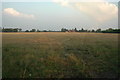
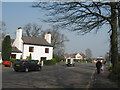
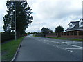
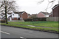
20 photos from this area
Area Information
Key information about the WA8 9QY including its size, population, and administrative classification.
- Area Type
- Postcode
- Area Size
- 9839 m²
- Population
- 1599
- Population Density
- 2386 people/km²
House Prices in WA8 9QY
19
Properties
£178,314
Average Sold Price
£60,000
Lowest Price
£280,000
Highest Price
Showing 19 properties
| Address | Type | Beds | Baths | Last Sale Price | Last Sale Date | |
|---|---|---|---|---|---|---|
| 11 Minton Way, Widnes, WA8 9QY | Detached | 2 | 1 | £280,000 | May 2024 | |
| 33 Minton Way, Widnes, WA8 9QY | Detached | 3 | 2 | £200,000 | Nov 2023 | |
| 37 Minton Way, Widnes, WA8 9QY | house | - | - | £253,000 | Feb 2022 | |
| 9 Minton Way, Widnes, WA8 9QY | Detached | 2 | 1 | £218,000 | May 2021 | |
| 29 Minton Way, Widnes, WA8 9QY | house | - | - | £185,000 | Nov 2017 | |
| 27 Minton Way, Widnes, WA8 9QY | Detached | 5 | - | £235,000 | Aug 2015 | |
| 21 Minton Way, Widnes, WA8 9QY | Detached | - | - | £141,000 | Mar 2009 | |
| 3 Minton Way, Widnes, WA8 9QY | Detached | - | - | £175,000 | Nov 2007 | |
| 5 Minton Way, Widnes, WA8 9QY | Detached | - | - | £126,500 | Jun 2003 | |
| 1 Minton Way, Widnes, WA8 9QY | Detached | - | - | £87,950 | Oct 2001 |
Page 1 of 2
Energy Efficiency in WA8 9QY
Amenities
Schools
| Rank | School | Type | Entry gender | Ages |
|---|
Explore more schools in this area
Go to Schools tabDemographics
Household Size
Two person
most common
Accommodation Type
Houses
most common
Tenure
93
majority
Ethnic Group
White
most common
Religion
N/A
most common
Household Composition
N/A
most common
Age
47
median
Adults (30-64 years)
most common
Household Deprivation
N/A
with no deprivation
NS-SEC
40
in Lower managerial occupations
Explore more demographic insights in this area
Go to Demographics tabPlanning
Planning Constraints
- Flood RiskPremium
- Ramsar Wetland SitesPremium
- Area of Outstanding Natural BeautyPremium
- Protected Nature ReservePremium
- Protected WoodlandPremium