Area Overview for WA8 8UT
Photos of WA8 8UT
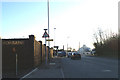

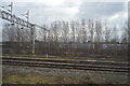
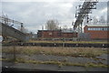
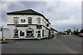
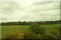
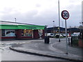
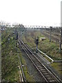
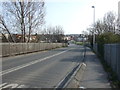
15 photos from this area
Area Information
Key information about the WA8 8UT including its size, population, and administrative classification.
- Area Type
- Postcode
- Area Size
- 7774 m²
- Population
- 2142
- Population Density
- 360 people/km²
House Prices in WA8 8UT
20
Properties
£72,400
Average Sold Price
£40,000
Lowest Price
£113,000
Highest Price
Showing 20 properties
| Address | Type | Beds | Baths | Last Sale Price | Last Sale Date | |
|---|---|---|---|---|---|---|
| 410 Hale Road, Widnes, WA8 8UT | house | - | - | £95,000 | Apr 2020 | |
| 420 Hale Road, Widnes, WA8 8UT | Bungalow | 2 | - | £108,000 | Feb 2016 | |
| 398 Hale Road, Widnes, WA8 8UT | house | 3 | - | £84,200 | May 2011 | |
| 422B Hale Road, Widnes, WA8 8UT | Semi-detached | 3 | 1 | £113,000 | Jul 2006 | |
| 392 Hale Road, Widnes, WA8 8UT | house | - | - | £40,000 | Apr 2002 | |
| 422A Hale Road, Widnes, WA8 8UT | Semi-detached | 3 | - | £57,500 | Sep 2000 | |
| 414 Hale Road, Widnes, WA8 8UT | Semi-detached | - | - | £41,500 | Jun 1998 | |
| 418 Hale Road, Widnes, WA8 8UT | house | - | - | £40,000 | Aug 1996 | |
| 386 Hale Road, Widnes, WA8 8UT | Terraced | - | - | - | - | |
| 400 Hale Road, Widnes, WA8 8UT | Semi-detached | - | - | - | - |
Page 1 of 2
Energy Efficiency in WA8 8UT
Amenities
Schools
| Rank | School | Type | Entry gender | Ages |
|---|
Explore more schools in this area
Go to Schools tabDemographics
Household Size
One person
most common
Accommodation Type
Houses
most common
Tenure
58
majority
Ethnic Group
White
most common
Religion
N/A
most common
Household Composition
N/A
most common
Age
47
median
Adults (30-64 years)
most common
Household Deprivation
N/A
with no deprivation
NS-SEC
22
in Lower managerial occupations
Explore more demographic insights in this area
Go to Demographics tabPlanning
Planning Constraints
- Flood RiskPremium
- Ramsar Wetland SitesPremium
- Area of Outstanding Natural BeautyPremium
- Protected Nature ReservePremium
- Protected WoodlandPremium