Area Overview for WA8 8SZ
Photos of WA8 8SZ
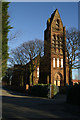
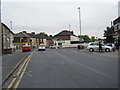
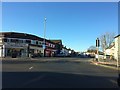
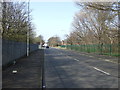

8 photos from this area
Area Information
Key information about the WA8 8SZ including its size, population, and administrative classification.
- Area Type
- Postcode
- Area Size
- 8828 m²
- Population
- 1475
- Population Density
- 875 people/km²
House Prices in WA8 8SZ
20
Properties
£107,562
Average Sold Price
£65,000
Lowest Price
£160,000
Highest Price
Showing 20 properties
| Address | Type | Beds | Baths | Last Sale Price | Last Sale Date | |
|---|---|---|---|---|---|---|
| 182 Hale Road, Widnes, WA8 8SZ | Terraced | 2 | 1 | £105,000 | May 2025 | |
| 180 Hale Road, Widnes, WA8 8SZ | Terraced | 2 | 1 | £105,000 | Mar 2024 | |
| 188 Hale Road, Widnes, WA8 8SZ | Terraced | 2 | 1 | £107,000 | Jul 2023 | |
| 3, Hale Mews, Hale Road, Widnes, WA8 8SZ | Semi-detached | 3 | 1 | £100,000 | Oct 2022 | |
| 1, Bretherton Cottage, Hale Road, Widnes, WA8 8SZ | house | - | - | £159,000 | Jun 2022 | |
| 190 Hale Road, Widnes, WA8 8SZ | Terraced | 2 | 1 | £97,750 | Mar 2022 | |
| 1, Hale Mews, Hale Road, Widnes, WA8 8SZ | Semi-detached | 3 | 1 | £79,100 | Nov 2016 | |
| 3, Bretherton Cottage, Hale Road, Widnes, WA8 8SZ | house | - | - | £113,000 | Feb 2015 | |
| 194 Hale Road, Widnes, WA8 8SZ | Terraced | 2 | - | £65,000 | Jun 2014 | |
| 186 Hale Road, Widnes, WA8 8SZ | house | - | - | £79,500 | Aug 2006 |
Page 1 of 2
Energy Efficiency in WA8 8SZ
Amenities
Schools
| Rank | School | Type | Entry gender | Ages |
|---|
Explore more schools in this area
Go to Schools tabDemographics
Household Size
Family (3-5 people)
most common
Accommodation Type
Houses
most common
Tenure
68
majority
Ethnic Group
White
most common
Religion
N/A
most common
Household Composition
N/A
most common
Age
47
median
Adults (30-64 years)
most common
Household Deprivation
N/A
with no deprivation
NS-SEC
24
in Lower managerial occupations
Explore more demographic insights in this area
Go to Demographics tabPlanning
Planning Constraints
- Flood RiskPremium
- Ramsar Wetland SitesPremium
- Area of Outstanding Natural BeautyPremium
- Protected Nature ReservePremium
- Protected WoodlandPremium