Area Overview for WA8 8RW
Photos of WA8 8RW
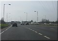
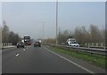
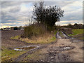
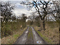
9 photos from this area
Area Information
Key information about the WA8 8RW including its size, population, and administrative classification.
- Area Type
- Postcode
- Area Size
- 30.4 hectares
- Population
- 2409
- Population Density
- 222 people/km²
House Prices in WA8 8RW
26
Properties
£144,532
Average Sold Price
£54,000
Lowest Price
£240,000
Highest Price
Showing 26 properties
| Address | Type | Beds | Baths | Last Sale Price | Last Sale Date | |
|---|---|---|---|---|---|---|
| 78 Clincton View, Widnes, WA8 8RW | house | - | - | £220,000 | Jan 2025 | |
| 74 Clincton View, Widnes, WA8 8RW | house | - | - | £240,000 | Apr 2023 | |
| 60 Clincton View, Widnes, WA8 8RW | Retail | 3 | 1 | £240,000 | Jan 2023 | |
| 98 Clincton View, Widnes, WA8 8RW | house | - | - | £175,000 | Jun 2020 | |
| 88 Clincton View, Widnes, WA8 8RW | house | - | - | £175,000 | Sep 2019 | |
| 56 Clincton View, Widnes, WA8 8RW | house | - | - | £155,000 | Jun 2019 | |
| 72 Clincton View, Widnes, WA8 8RW | Semi-detached | 4 | - | £198,000 | Jan 2019 | |
| 86 Clincton View, Widnes, WA8 8RW | house | - | - | £120,000 | Jul 2018 | |
| 70 Clincton View, Widnes, WA8 8RW | house | - | - | £160,100 | Jul 2016 | |
| 92 Clincton View, Widnes, WA8 8RW | house | - | - | £118,500 | Nov 2015 |
Page 1 of 3
Energy Efficiency in WA8 8RW
Amenities
Schools
| Rank | School | Type | Entry gender | Ages |
|---|
Explore more schools in this area
Go to Schools tabDemographics
Household Size
Family (3-5 people)
most common
Accommodation Type
Houses
most common
Tenure
87
majority
Ethnic Group
White
most common
Religion
N/A
most common
Household Composition
N/A
most common
Age
47
median
Adults (30-64 years)
most common
Household Deprivation
N/A
with no deprivation
NS-SEC
41
in Lower managerial occupations
Explore more demographic insights in this area
Go to Demographics tabPlanning
Planning Constraints
- Flood RiskPremium
- Ramsar Wetland SitesPremium
- Area of Outstanding Natural BeautyPremium
- Protected Nature ReservePremium
- Protected WoodlandPremium