Area Overview for WA8 8QG
Photos of WA8 8QG
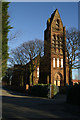
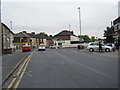
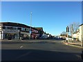
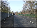

8 photos from this area
Area Information
Key information about the WA8 8QG including its size, population, and administrative classification.
- Area Type
- Postcode
- Area Size
- 5586 m²
- Population
- 1780
- Population Density
- 4725 people/km²
House Prices in WA8 8QG
20
Properties
£90,086
Average Sold Price
£700
Lowest Price
£148,000
Highest Price
Showing 20 properties
| Address | Type | Beds | Baths | Last Sale Price | Last Sale Date | |
|---|---|---|---|---|---|---|
| 21 Ditchfield Road, Widnes, WA8 8QG | Semi-detached | 3 | 1 | £148,000 | Jun 2025 | |
| 39 Ditchfield Road, Widnes, WA8 8QG | Semi-detached | 3 | 1 | £115,000 | Mar 2025 | |
| 13 Ditchfield Road, Widnes, WA8 8QG | Semi-detached | 2 | 1 | £115,000 | Jan 2024 | |
| 23 Ditchfield Road, Widnes, WA8 8QG | Retail | 2 | 1 | £130,000 | Oct 2022 | |
| 15 Ditchfield Road, Widnes, WA8 8QG | house | - | - | £700 | Oct 2021 | |
| 27 Ditchfield Road, Widnes, WA8 8QG | house | - | - | £143,000 | Jun 2021 | |
| 41 Ditchfield Road, Widnes, WA8 8QG | Semi-detached | 2 | 2 | £97,500 | Feb 2021 | |
| 37 Ditchfield Road, Widnes, WA8 8QG | Semi-detached | 3 | 1 | £86,000 | Oct 2017 | |
| 25A Ditchfield Road, Widnes, WA8 8QG | house | - | - | £97,500 | Sep 2015 | |
| 9 Ditchfield Road, Widnes, WA8 8QG | house | - | - | £61,000 | Mar 2014 |
Page 1 of 2
Energy Efficiency in WA8 8QG
Amenities
Schools
| Rank | School | Type | Entry gender | Ages |
|---|
Explore more schools in this area
Go to Schools tabDemographics
Household Size
Family (3-5 people)
most common
Accommodation Type
Houses
most common
Tenure
55
majority
Ethnic Group
White
most common
Religion
N/A
most common
Household Composition
N/A
most common
Age
47
median
Adults (30-64 years)
most common
Household Deprivation
N/A
with no deprivation
NS-SEC
17
in Lower managerial occupations
Explore more demographic insights in this area
Go to Demographics tabPlanning
Planning Constraints
- Flood RiskPremium
- Ramsar Wetland SitesPremium
- Area of Outstanding Natural BeautyPremium
- Protected Nature ReservePremium
- Protected WoodlandPremium