Area Overview for WA8 8PW
Photos of WA8 8PW
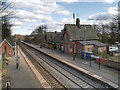
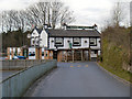
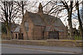
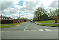
32 photos from this area
Area Information
Key information about the WA8 8PW including its size, population, and administrative classification.
- Area Type
- Postcode
- Area Size
- 3.1 hectares
- Population
- 1590
- Population Density
- 4585 people/km²
House Prices in WA8 8PW
31
Properties
£203,913
Average Sold Price
£65,200
Lowest Price
£360,000
Highest Price
Showing 31 properties
| Address | Type | Beds | Baths | Last Sale Price | Last Sale Date | |
|---|---|---|---|---|---|---|
| 101 Mayfield Avenue, Widnes, WA8 8PW | Bungalow | 3 | 1 | £257,500 | May 2024 | |
| 83 Mayfield Avenue, Widnes, WA8 8PW | Semi-detached | 3 | 1 | £265,000 | Sep 2023 | |
| 60 Mayfield Avenue, Widnes, WA8 8PW | Bungalow | - | - | £360,000 | Feb 2023 | |
| 77 Mayfield Avenue, Widnes, WA8 8PW | Bungalow | 3 | 1 | £265,000 | Sep 2021 | |
| 60A Mayfield Avenue, Widnes, WA8 8PW | Detached | 4 | 2 | £270,000 | Aug 2021 | |
| 103 Mayfield Avenue, Widnes, WA8 8PW | house | - | - | £175,000 | Aug 2021 | |
| 64 Mayfield Avenue, Widnes, WA8 8PW | Bungalow | 2 | 1 | £242,000 | Sep 2019 | |
| 93 Mayfield Avenue, Widnes, WA8 8PW | Bungalow | 2 | 1 | £165,000 | May 2017 | |
| 97 Mayfield Avenue, Widnes, WA8 8PW | Semi-detached | 3 | 1 | £207,000 | Apr 2016 | |
| 70 Mayfield Avenue, Widnes, WA8 8PW | Detached | 5 | - | £300,000 | Feb 2016 |
Page 1 of 4
Energy Efficiency in WA8 8PW
Amenities
Schools
| Rank | School | Type | Entry gender | Ages |
|---|
Explore more schools in this area
Go to Schools tabDemographics
Household Size
Two person
most common
Accommodation Type
Houses
most common
Tenure
65
majority
Ethnic Group
White
most common
Religion
N/A
most common
Household Composition
N/A
most common
Age
47
median
Adults (30-64 years)
most common
Household Deprivation
N/A
with no deprivation
NS-SEC
24
in Lower managerial occupations
Explore more demographic insights in this area
Go to Demographics tabPlanning
Planning Constraints
- Flood RiskPremium
- Ramsar Wetland SitesPremium
- Area of Outstanding Natural BeautyPremium
- Protected Nature ReservePremium
- Protected WoodlandPremium