Area Overview for WA8 7NT
Photos of WA8 7NT
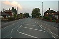
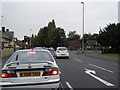
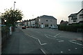
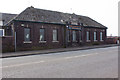
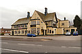
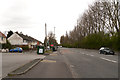
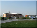
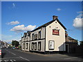
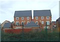
9 photos from this area
Area Information
Key information about the WA8 7NT including its size, population, and administrative classification.
- Area Type
- Postcode
- Area Size
- 5.0 hectares
- Population
- 1521
- Population Density
- 4190 people/km²
House Prices in WA8 7NT
77
Properties
£179,131
Average Sold Price
£60,000
Lowest Price
£314,000
Highest Price
Showing 77 properties
| Address | Type | Beds | Baths | Last Sale Price | Last Sale Date | |
|---|---|---|---|---|---|---|
| 90 Lynton Crescent, Widnes, WA8 7NT | Semi-detached | 3 | 1 | £248,000 | Jun 2024 | |
| 94 Lynton Crescent, Widnes, WA8 7NT | Semi-detached | 3 | 2 | £248,000 | May 2024 | |
| 83 Lynton Crescent, Widnes, WA8 7NT | Semi-detached | 3 | - | £314,000 | Apr 2024 | |
| 102 Lynton Crescent, Widnes, WA8 7NT | Semi-detached | 3 | 1 | £275,000 | Oct 2022 | |
| 57 Lynton Crescent, Widnes, WA8 7NT | house | - | - | £266,000 | May 2022 | |
| 80 Lynton Crescent, Widnes, WA8 7NT | house | - | - | £277,750 | Mar 2022 | |
| 140 Lynton Crescent, Widnes, WA8 7NT | house | - | - | £250,000 | Nov 2021 | |
| 55 Lynton Crescent, Widnes, WA8 7NT | Semi-detached | 4 | - | £267,500 | Nov 2021 | |
| 132 Lynton Crescent, Widnes, WA8 7NT | house | - | - | £280,000 | Sep 2021 | |
| 130 Lynton Crescent, Widnes, WA8 7NT | house | - | - | £265,000 | Sep 2021 |
Page 1 of 8
Energy Efficiency in WA8 7NT
Amenities
Schools
| Rank | School | Type | Entry gender | Ages |
|---|
Explore more schools in this area
Go to Schools tabDemographics
Household Size
Two person
most common
Accommodation Type
Houses
most common
Tenure
80
majority
Ethnic Group
White
most common
Religion
N/A
most common
Household Composition
N/A
most common
Age
47
median
Adults (30-64 years)
most common
Household Deprivation
N/A
with no deprivation
NS-SEC
26
in Lower managerial occupations
Explore more demographic insights in this area
Go to Demographics tabPlanning
Planning Constraints
- Flood RiskPremium
- Ramsar Wetland SitesPremium
- Area of Outstanding Natural BeautyPremium
- Protected Nature ReservePremium
- Protected WoodlandPremium