Area Overview for WA8 7BQ
Photos of WA8 7BQ
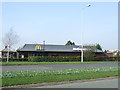
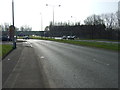
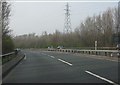
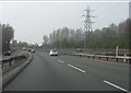
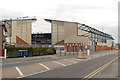
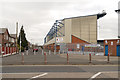
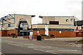
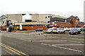
13 photos from this area
Area Information
Key information about the WA8 7BQ including its size, population, and administrative classification.
- Area Type
- Postcode
- Area Size
- 8.3 hectares
- Population
- 1916
- Population Density
- 3903 people/km²
House Prices in WA8 7BQ
60
Properties
£95,167
Average Sold Price
£30,000
Lowest Price
£142,000
Highest Price
Showing 60 properties
| Address | Type | Beds | Baths | Last Sale Price | Last Sale Date | |
|---|---|---|---|---|---|---|
| 218 Milton Avenue, Widnes, WA8 7BQ | Semi-detached | 4 | 1 | £142,000 | Oct 2020 | |
| 192 Milton Avenue, Widnes, WA8 7BQ | Flat | - | - | £30,000 | May 2018 | |
| 188 Milton Avenue, Widnes, WA8 7BQ | house | - | - | £82,000 | Oct 2017 | |
| 157 Milton Avenue, Widnes, WA8 7BQ | house | 3 | - | £90,000 | Dec 2010 | |
| 115 Milton Avenue, Widnes, WA8 7BQ | house | - | - | £122,000 | Jun 2006 | |
| 113 Milton Avenue, Widnes, WA8 7BQ | house | - | - | £105,000 | Apr 2006 | |
| 190 Milton Avenue, Widnes, WA8 7BQ | Terraced | 4 | - | - | - | |
| 141 Milton Avenue, Widnes, WA8 7BQ | Terraced | - | - | - | - | |
| 143 Milton Avenue, Widnes, WA8 7BQ | house | - | - | - | - | |
| 153 Milton Avenue, Widnes, WA8 7BQ | house | - | - | - | - |
Page 1 of 6
Energy Efficiency in WA8 7BQ
Amenities
Schools
| Rank | School | Type | Entry gender | Ages |
|---|
Explore more schools in this area
Go to Schools tabDemographics
Household Size
Family (3-5 people)
most common
Accommodation Type
Houses
most common
Tenure
34
majority
Ethnic Group
White
most common
Religion
N/A
most common
Household Composition
N/A
most common
Age
47
median
Adults (30-64 years)
most common
Household Deprivation
N/A
with no deprivation
NS-SEC
12
in Lower managerial occupations
Explore more demographic insights in this area
Go to Demographics tabPlanning
Planning Constraints
- Flood RiskPremium
- Ramsar Wetland SitesPremium
- Area of Outstanding Natural BeautyPremium
- Protected Nature ReservePremium
- Protected WoodlandPremium