Area Overview for WA8 7BP
Photos of WA8 7BP
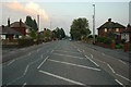
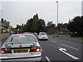
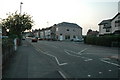
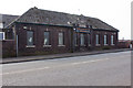
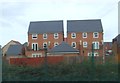
9 photos from this area
Area Information
Key information about the WA8 7BP including its size, population, and administrative classification.
- Area Type
- Postcode
- Area Size
- 3.1 hectares
- Population
- 1802
- Population Density
- 2488 people/km²
House Prices in WA8 7BP
80
Properties
£86,354
Average Sold Price
£34,000
Lowest Price
£126,000
Highest Price
Showing 80 properties
| Address | Type | Beds | Baths | Last Sale Price | Last Sale Date | |
|---|---|---|---|---|---|---|
| 44 Stewards Avenue, Widnes, WA8 7BP | Semi-detached | 4 | 2 | £104,000 | May 2025 | |
| 129 Stewards Avenue, Widnes, WA8 7BP | Semi-detached | 4 | 1 | £100,000 | Jan 2024 | |
| 101 Stewards Avenue, Widnes, WA8 7BP | Terraced | 3 | 1 | £85,000 | Oct 2023 | |
| 131 Stewards Avenue, Widnes, WA8 7BP | house | - | - | £126,000 | Mar 2022 | |
| 66 Stewards Avenue, Widnes, WA8 7BP | Terraced | - | - | £92,000 | Apr 2020 | |
| 103 Stewards Avenue, Widnes, WA8 7BP | house | - | - | £85,000 | Jun 2019 | |
| 139 Stewards Avenue, Widnes, WA8 7BP | Semi-detached | 4 | 1 | £107,500 | Jul 2018 | |
| 89 Stewards Avenue, Widnes, WA8 7BP | Semi-detached | 3 | 1 | £107,000 | Dec 2017 | |
| 49 Stewards Avenue, Widnes, WA8 7BP | house | - | - | £110,000 | Aug 2017 | |
| 72 Stewards Avenue, Widnes, WA8 7BP | Terraced | 5 | 1 | £70,000 | Mar 2017 |
Page 1 of 8
Energy Efficiency in WA8 7BP
Amenities
Schools
| Rank | School | Type | Entry gender | Ages |
|---|
Explore more schools in this area
Go to Schools tabDemographics
Household Size
Family (3-5 people)
most common
Accommodation Type
Houses
most common
Tenure
71
majority
Ethnic Group
White
most common
Religion
N/A
most common
Household Composition
N/A
most common
Age
47
median
Adults (30-64 years)
most common
Household Deprivation
N/A
with no deprivation
NS-SEC
23
in Lower managerial occupations
Explore more demographic insights in this area
Go to Demographics tabPlanning
Planning Constraints
- Flood RiskPremium
- Ramsar Wetland SitesPremium
- Area of Outstanding Natural BeautyPremium
- Protected Nature ReservePremium
- Protected WoodlandPremium