Area Overview for WA8 6NX
Photos of WA8 6NX
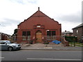
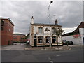
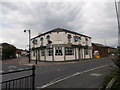


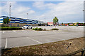

46 photos from this area
Area Information
Key information about the WA8 6NX including its size, population, and administrative classification.
- Area Type
- Postcode
- Area Size
- 5634 m²
- Population
- 1556
- Population Density
- 6532 people/km²
House Prices in WA8 6NX
20
Properties
£129,600
Average Sold Price
£98,000
Lowest Price
£155,000
Highest Price
Showing 20 properties
| Address | Type | Beds | Baths | Last Sale Price | Last Sale Date | |
|---|---|---|---|---|---|---|
| 122 Dickson Street, Widnes, WA8 6NX | Semi-detached | 3 | 1 | £130,000 | Feb 2025 | |
| 116 Dickson Street, Widnes, WA8 6NX | Semi-detached | 3 | 1 | £155,000 | Jul 2021 | |
| 53 Dickson Street, Widnes, WA8 6NX | Detached | 3 | 1 | £110,000 | Nov 2020 | |
| 118 Dickson Street, Widnes, WA8 6NX | Detached | 3 | - | £155,000 | Feb 2016 | |
| 120 Dickson Street, Widnes, WA8 6NX | house | 3 | - | £98,000 | Apr 2014 | |
| 31 Dickson Street, Widnes, WA8 6NX | Retail | 3 | 1 | - | - | |
| 33 Dickson Street, Widnes, WA8 6NX | Semi-detached | 3 | 1 | - | - | |
| 49A Dickson Street, Widnes, WA8 6NX | Bungalow | - | - | - | - | |
| 51A Dickson Street, Widnes, WA8 6NX | house | - | - | - | - | |
| Flat, 49 Dickson Street, Widnes, WA8 6NX | Flat | - | - | - | - |
Page 1 of 2
Energy Efficiency in WA8 6NX
Amenities
Schools
| Rank | School | Type | Entry gender | Ages |
|---|
Explore more schools in this area
Go to Schools tabDemographics
Household Size
Family (3-5 people)
most common
Accommodation Type
Houses
most common
Tenure
53
majority
Ethnic Group
White
most common
Religion
N/A
most common
Household Composition
N/A
most common
Age
47
median
Adults (30-64 years)
most common
Household Deprivation
N/A
with no deprivation
NS-SEC
18
in Lower managerial occupations
Explore more demographic insights in this area
Go to Demographics tabPlanning
Planning Constraints
- Flood RiskPremium
- Ramsar Wetland SitesPremium
- Area of Outstanding Natural BeautyPremium
- Protected Nature ReservePremium
- Protected WoodlandPremium