Area Overview for WA8 5AF
Photos of WA8 5AF
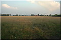
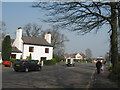
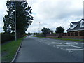
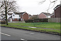
20 photos from this area
Area Information
Key information about the WA8 5AF including its size, population, and administrative classification.
- Area Type
- Postcode
- Area Size
- 3.0 hectares
- Population
- 2882
- Population Density
- 1227 people/km²
House Prices in WA8 5AF
38
Properties
£325,696
Average Sold Price
£248,500
Lowest Price
£575,000
Highest Price
Showing 38 properties
| Address | Type | Beds | Baths | Last Sale Price | Last Sale Date | |
|---|---|---|---|---|---|---|
| 10 Black Horse Lane, Widnes, WA8 5AF | Detached | 4 | 3 | £365,000 | Jul 2024 | |
| 15 Black Horse Lane, Widnes, WA8 5AF | house | - | - | £395,000 | Jun 2024 | |
| 3 Black Horse Lane, Widnes, WA8 5AF | Detached | 4 | 1 | £380,000 | May 2024 | |
| 25 Black Horse Lane, Widnes, WA8 5AF | Detached | 5 | 3 | £575,000 | Mar 2024 | |
| 16 Black Horse Lane, Widnes, WA8 5AF | house | - | - | £405,000 | Sep 2022 | |
| 8 Black Horse Lane, Widnes, WA8 5AF | Detached | 4 | - | £420,000 | Jul 2021 | |
| 17 Black Horse Lane, Widnes, WA8 5AF | house | - | - | £385,000 | Feb 2021 | |
| 18 Black Horse Lane, Widnes, WA8 5AF | Detached | 4 | 1 | £345,000 | Jan 2021 | |
| 30 Black Horse Lane, Widnes, WA8 5AF | Detached | 4 | 3 | £360,000 | Dec 2020 | |
| 38 Black Horse Lane, Widnes, WA8 5AF | Detached | 4 | 2 | £340,000 | Oct 2020 |
Page 1 of 4
Energy Efficiency in WA8 5AF
Amenities
Schools
| Rank | School | Type | Entry gender | Ages |
|---|
Explore more schools in this area
Go to Schools tabDemographics
Household Size
Family (3-5 people)
most common
Accommodation Type
Houses
most common
Tenure
87
majority
Ethnic Group
White
most common
Religion
N/A
most common
Household Composition
N/A
most common
Age
47
median
Adults (30-64 years)
most common
Household Deprivation
N/A
with no deprivation
NS-SEC
47
in Lower managerial occupations
Explore more demographic insights in this area
Go to Demographics tabPlanning
Planning Constraints
- Flood RiskPremium
- Ramsar Wetland SitesPremium
- Area of Outstanding Natural BeautyPremium
- Protected Nature ReservePremium
- Protected WoodlandPremium