Area Overview for WA8 4YL
Photos of WA8 4YL
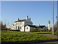
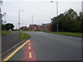
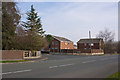

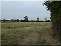
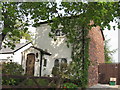
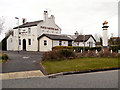
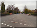
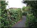
11 photos from this area
Area Information
Key information about the WA8 4YL including its size, population, and administrative classification.
- Area Type
- Postcode
- Area Size
- 2.1 hectares
- Population
- 1182
- Population Density
- 3268 people/km²
House Prices in WA8 4YL
39
Properties
£92,641
Average Sold Price
£25,000
Lowest Price
£160,000
Highest Price
Showing 39 properties
| Address | Type | Beds | Baths | Last Sale Price | Last Sale Date | |
|---|---|---|---|---|---|---|
| 37A Simonside, Widnes, WA8 4YL | Semi-detached | 1 | 1 | £105,000 | Mar 2025 | |
| 6 Simonside, Widnes, WA8 4YL | house | - | - | £160,000 | Feb 2022 | |
| 17 Simonside, Widnes, WA8 4YL | house | - | - | £144,950 | Aug 2020 | |
| 39 Simonside, Widnes, WA8 4YL | Semi-detached | 3 | 1 | £120,000 | Jun 2020 | |
| 29 Simonside, Widnes, WA8 4YL | house | - | - | £105,000 | Sep 2019 | |
| 8 Simonside, Widnes, WA8 4YL | house | - | - | £132,000 | Nov 2017 | |
| 24 Simonside, Widnes, WA8 4YL | house | - | - | £75,000 | Oct 2017 | |
| 16 Simonside, Widnes, WA8 4YL | house | - | - | £115,000 | Jul 2012 | |
| 11 Simonside, Widnes, WA8 4YL | Semi-detached | - | - | £90,000 | Apr 2012 | |
| 37 Simonside, Widnes, WA8 4YL | Terraced | - | - | £80,000 | Aug 2008 |
Page 1 of 4
Energy Efficiency in WA8 4YL
Amenities
Schools
| Rank | School | Type | Entry gender | Ages |
|---|
Explore more schools in this area
Go to Schools tabDemographics
Household Size
Two person
most common
Accommodation Type
Houses
most common
Tenure
91
majority
Ethnic Group
White
most common
Religion
N/A
most common
Household Composition
N/A
most common
Age
47
median
Adults (30-64 years)
most common
Household Deprivation
N/A
with no deprivation
NS-SEC
34
in Lower managerial occupations
Explore more demographic insights in this area
Go to Demographics tabPlanning
Planning Constraints
- Flood RiskPremium
- Ramsar Wetland SitesPremium
- Area of Outstanding Natural BeautyPremium
- Protected Nature ReservePremium
- Protected WoodlandPremium