Area Overview for WA8 0EZ
Photos of WA8 0EZ


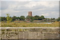

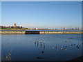
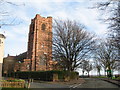


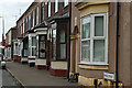
100 photos from this area
Area Information
Key information about the WA8 0EZ including its size, population, and administrative classification.
- Area Type
- Postcode
- Area Size
- 81.8 hectares
- Population
- 2268
- Population Density
- 874 people/km²
House Prices in WA8 0EZ
76
Properties
£68,077
Average Sold Price
£759
Lowest Price
£99,000
Highest Price
Showing 76 properties
| Address | Type | Beds | Baths | Last Sale Price | Last Sale Date | |
|---|---|---|---|---|---|---|
| 46 Terrace Road, Widnes, WA8 0EZ | house | - | - | £88,000 | Jul 2023 | |
| 66 Terrace Road, Widnes, WA8 0EZ | house | - | - | £99,000 | Feb 2023 | |
| 25 Terrace Road, Widnes, WA8 0EZ | Retail | 2 | - | £95,250 | Sep 2022 | |
| 51 Terrace Road, Widnes, WA8 0EZ | house | - | - | £85,000 | Mar 2022 | |
| 40 Terrace Road, Widnes, WA8 0EZ | house | - | - | £759 | Dec 2020 | |
| 42 Terrace Road, Widnes, WA8 0EZ | house | - | - | £80,000 | Dec 2020 | |
| 8 Terrace Road, Widnes, WA8 0EZ | Terraced | 3 | - | £82,000 | Aug 2019 | |
| 23 Terrace Road, Widnes, WA8 0EZ | house | - | - | £88,000 | Apr 2019 | |
| 39 Terrace Road, Widnes, WA8 0EZ | Terraced | 2 | 2 | £76,000 | Dec 2018 | |
| 48 Terrace Road, Widnes, WA8 0EZ | house | - | - | £67,000 | Jan 2018 |
Page 1 of 8
Energy Efficiency in WA8 0EZ
Amenities
Schools
| Rank | School | Type | Entry gender | Ages |
|---|
Explore more schools in this area
Go to Schools tabDemographics
Household Size
One person
most common
Accommodation Type
Houses
most common
Tenure
31
majority
Ethnic Group
White
most common
Religion
N/A
most common
Household Composition
N/A
most common
Age
47
median
Adults (30-64 years)
most common
Household Deprivation
N/A
with no deprivation
NS-SEC
14
in Lower managerial occupations
Explore more demographic insights in this area
Go to Demographics tabPlanning
Planning Constraints
- Flood RiskPremium
- Ramsar Wetland SitesPremium
- Area of Outstanding Natural BeautyPremium
- Protected Nature ReservePremium
- Protected WoodlandPremium