Area Overview for WA7 4LD
Photos of WA7 4LD

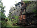
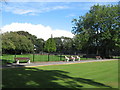
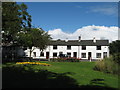
19 photos from this area
Area Information
Key information about the WA7 4LD including its size, population, and administrative classification.
- Area Type
- Postcode
- Area Size
- 2.8 hectares
- Population
- 1195
- Population Density
- 548 people/km²
House Prices in WA7 4LD
19
Properties
£136,204
Average Sold Price
£42,000
Lowest Price
£335,000
Highest Price
Showing 19 properties
| Address | Type | Beds | Baths | Last Sale Price | Last Sale Date | |
|---|---|---|---|---|---|---|
| 48A Weston Road, Runcorn, WA7 4LD | Semi-detached | 4 | 3 | £335,000 | Aug 2024 | |
| 56 Weston Road, Runcorn, WA7 4LD | Semi-detached | 3 | 1 | £185,000 | May 2022 | |
| 58 Weston Road, Runcorn, WA7 4LD | house | - | - | £188,000 | Sep 2020 | |
| 88 Weston Road, Runcorn, WA7 4LD | house | - | - | £219,950 | Aug 2015 | |
| 62 Weston Road, Runcorn, WA7 4LD | Unknown | - | - | £73,000 | Jun 2012 | |
| 54 Weston Road, Runcorn, WA7 4LD | house | 3 | - | £156,000 | Apr 2011 | |
| 64 Weston Road, Runcorn, WA7 4LD | Terraced | 2 | 1 | £86,000 | Sep 2009 | |
| 68 Weston Road, Runcorn, WA7 4LD | Terraced | 2 | 1 | £42,000 | Jun 2009 | |
| The Bungalow, 60A Weston Road, Runcorn, WA7 4LD | Flat | 1 | - | £85,000 | Sep 2004 | |
| 60 Weston Road, Runcorn, WA7 4LD | Semi-detached | - | - | £110,000 | Mar 2004 |
Page 1 of 2
Energy Efficiency in WA7 4LD
Amenities
Schools
| Rank | School | Type | Entry gender | Ages |
|---|
Explore more schools in this area
Go to Schools tabDemographics
Household Size
Two person
most common
Accommodation Type
Houses
most common
Tenure
72
majority
Ethnic Group
White
most common
Religion
N/A
most common
Household Composition
N/A
most common
Age
47
median
Adults (30-64 years)
most common
Household Deprivation
N/A
with no deprivation
NS-SEC
25
in Lower managerial occupations
Explore more demographic insights in this area
Go to Demographics tabPlanning
Planning Constraints
- Flood RiskPremium
- Ramsar Wetland SitesPremium
- Area of Outstanding Natural BeautyPremium
- Protected Nature ReservePremium
- Protected WoodlandPremium