Area Overview for WA7 4DT
Photos of WA7 4DT


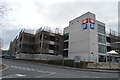


96 photos from this area
Area Information
Key information about the WA7 4DT including its size, population, and administrative classification.
- Area Type
- Postcode
- Area Size
- 2.3 hectares
- Population
- 1270
- Population Density
- 1345 people/km²
House Prices in WA7 4DT
42
Properties
£106,889
Average Sold Price
£43,000
Lowest Price
£140,000
Highest Price
Showing 42 properties
| Address | Type | Beds | Baths | Last Sale Price | Last Sale Date | |
|---|---|---|---|---|---|---|
| 70 Crofton Road, Runcorn, WA7 4DT | house | - | - | £140,000 | Mar 2024 | |
| 68 Crofton Road, Runcorn, WA7 4DT | Detached | 3 | 1 | £105,000 | Nov 2022 | |
| 84 Crofton Road, Runcorn, WA7 4DT | house | - | - | £90,000 | Nov 2022 | |
| 72 Crofton Road, Runcorn, WA7 4DT | house | 2 | - | £120,000 | Jan 2022 | |
| 78 Crofton Road, Runcorn, WA7 4DT | house | - | - | £131,000 | Nov 2021 | |
| 60 Crofton Road, Runcorn, WA7 4DT | house | - | - | £130,000 | Feb 2020 | |
| 54 Crofton Road, Runcorn, WA7 4DT | house | - | - | £107,000 | Mar 2016 | |
| 66 Crofton Road, Runcorn, WA7 4DT | Terraced | 2 | 1 | £80,000 | Jan 2015 | |
| 4 Crofton Road, Runcorn, WA7 4DT | house | 3 | - | £115,000 | Jun 2014 | |
| 12 Crofton Road, Runcorn, WA7 4DT | Semi-detached | 3 | - | £139,000 | Dec 2013 |
Page 1 of 5
Energy Efficiency in WA7 4DT
Amenities
Schools
| Rank | School | Type | Entry gender | Ages |
|---|
Explore more schools in this area
Go to Schools tabDemographics
Household Size
One person
most common
Accommodation Type
Houses
most common
Tenure
35
majority
Ethnic Group
White
most common
Religion
N/A
most common
Household Composition
N/A
most common
Age
47
median
Adults (30-64 years)
most common
Household Deprivation
N/A
with no deprivation
NS-SEC
29
in Lower managerial occupations
Explore more demographic insights in this area
Go to Demographics tabPlanning
Planning Constraints
- Flood RiskPremium
- Ramsar Wetland SitesPremium
- Area of Outstanding Natural BeautyPremium
- Protected Nature ReservePremium
- Protected WoodlandPremium