Area Overview for WA7 2TH
Photos of WA7 2TH
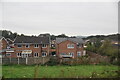
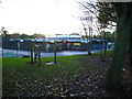
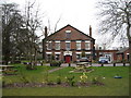
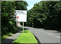
10 photos from this area
Area Information
Key information about the WA7 2TH including its size, population, and administrative classification.
- Area Type
- Postcode
- Area Size
- 1.7 hectares
- Population
- 1317
- Population Density
- 2400 people/km²
House Prices in WA7 2TH
43
Properties
£101,203
Average Sold Price
£28,000
Lowest Price
£150,000
Highest Price
Showing 43 properties
| Address | Type | Beds | Baths | Last Sale Price | Last Sale Date | |
|---|---|---|---|---|---|---|
| 34 Lapwing Grove, Runcorn, WA7 2TH | Terraced | 3 | 1 | £140,000 | Oct 2025 | |
| 12 Lapwing Grove, Runcorn, WA7 2TH | house | - | - | £110,000 | Jan 2025 | |
| 13 Lapwing Grove, Runcorn, WA7 2TH | Terraced | 3 | 1 | £120,000 | Sep 2024 | |
| 23 Lapwing Grove, Runcorn, WA7 2TH | Terraced | 3 | 1 | £140,000 | Jun 2024 | |
| 26 Lapwing Grove, Runcorn, WA7 2TH | house | - | - | £150,000 | Apr 2024 | |
| 24 Lapwing Grove, Runcorn, WA7 2TH | house | - | - | £127,500 | Apr 2024 | |
| 30 Lapwing Grove, Runcorn, WA7 2TH | Terraced | 3 | 1 | £120,000 | Jun 2023 | |
| 33 Lapwing Grove, Runcorn, WA7 2TH | house | - | - | £141,500 | Oct 2022 | |
| 40 Lapwing Grove, Runcorn, WA7 2TH | house | - | - | £95,000 | Aug 2021 | |
| 17 Lapwing Grove, Runcorn, WA7 2TH | house | - | - | £86,000 | May 2018 |
Page 1 of 5
Energy Efficiency in WA7 2TH
Amenities
Schools
| Rank | School | Type | Entry gender | Ages |
|---|
Explore more schools in this area
Go to Schools tabDemographics
Household Size
One person
most common
Accommodation Type
Houses
most common
Tenure
54
majority
Ethnic Group
White
most common
Religion
N/A
most common
Household Composition
N/A
most common
Age
47
median
Adults (30-64 years)
most common
Household Deprivation
N/A
with no deprivation
NS-SEC
19
in Lower managerial occupations
Explore more demographic insights in this area
Go to Demographics tabPlanning
Planning Constraints
- Flood RiskPremium
- Ramsar Wetland SitesPremium
- Area of Outstanding Natural BeautyPremium
- Protected Nature ReservePremium
- Protected WoodlandPremium