Area Overview for WA7 2NH
Photos of WA7 2NH
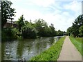
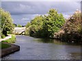
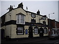
20 photos from this area
Area Information
Key information about the WA7 2NH including its size, population, and administrative classification.
- Area Type
- Postcode
- Area Size
- 1.2 hectares
- Population
- 1518
- Population Density
- 3520 people/km²
House Prices in WA7 2NH
39
Properties
£65,102
Average Sold Price
£13,120
Lowest Price
£122,500
Highest Price
Showing 39 properties
| Address | Type | Beds | Baths | Last Sale Price | Last Sale Date | |
|---|---|---|---|---|---|---|
| 46 Leaside, Runcorn, WA7 2NH | house | - | - | £122,500 | Jun 2025 | |
| 77 Leaside, Runcorn, WA7 2NH | Terraced | 3 | 1 | £115,000 | Mar 2025 | |
| 76 Leaside, Runcorn, WA7 2NH | house | - | - | £85,500 | Sep 2019 | |
| 59 Leaside, Runcorn, WA7 2NH | Semi-detached | 3 | 1 | £80,000 | Aug 2017 | |
| 58 Leaside, Runcorn, WA7 2NH | Semi-detached | 3 | 1 | £53,000 | Nov 2010 | |
| 75 Leaside, Runcorn, WA7 2NH | house | - | - | £85,000 | Sep 2008 | |
| 74 Leaside, Runcorn, WA7 2NH | house | - | - | £60,000 | May 2007 | |
| 72 Leaside, Runcorn, WA7 2NH | Terraced | - | - | £48,500 | Mar 2004 | |
| 82 Leaside, Runcorn, WA7 2NH | Bungalow | - | - | £26,500 | Jul 2002 | |
| 57 Leaside, Runcorn, WA7 2NH | Terraced | - | - | £13,120 | Mar 1998 |
Page 1 of 4
Energy Efficiency in WA7 2NH
Amenities
Schools
| Rank | School | Type | Entry gender | Ages |
|---|
Explore more schools in this area
Go to Schools tabDemographics
Household Size
One person
most common
Accommodation Type
Houses
most common
Tenure
48
majority
Ethnic Group
White
most common
Religion
N/A
most common
Household Composition
N/A
most common
Age
47
median
Adults (30-64 years)
most common
Household Deprivation
N/A
with no deprivation
NS-SEC
17
in Lower managerial occupations
Explore more demographic insights in this area
Go to Demographics tabPlanning
Planning Constraints
- Flood RiskPremium
- Ramsar Wetland SitesPremium
- Area of Outstanding Natural BeautyPremium
- Protected Nature ReservePremium
- Protected WoodlandPremium