Area Overview for WA7 1EB
Photos of WA7 1EB
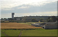
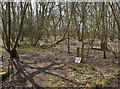
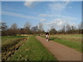
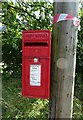
12 photos from this area
Area Information
Key information about the WA7 1EB including its size, population, and administrative classification.
- Area Type
- Postcode
- Area Size
- 5.5 hectares
- Population
- 2658
- Population Density
- 912 people/km²
House Prices in WA7 1EB
75
Properties
£245,475
Average Sold Price
£186,750
Lowest Price
£420,000
Highest Price
Showing 75 properties
| Address | Type | Beds | Baths | Last Sale Price | Last Sale Date | |
|---|---|---|---|---|---|---|
| 16 Wharford Lane, Runcorn, WA7 1EB | Detached | 4 | 2 | £337,250 | Nov 2025 | |
| 120 Wharford Lane, Runcorn, WA7 1EB | Detached | 4 | 3 | £342,000 | Aug 2025 | |
| 140 Wharford Lane, Runcorn, WA7 1EB | Detached | 3 | 2 | £283,500 | Jul 2025 | |
| 24 Wharford Lane, Runcorn, WA7 1EB | house | - | - | £260,000 | Jun 2025 | |
| 22 Wharford Lane, Runcorn, WA7 1EB | house | - | - | £260,000 | Feb 2025 | |
| 54 Wharford Lane, Runcorn, WA7 1EB | Semi-detached | 3 | 3 | £247,000 | Nov 2024 | |
| 132 Wharford Lane, Runcorn, WA7 1EB | Semi-detached | 3 | 2 | £246,000 | Aug 2023 | |
| 26 Wharford Lane, Runcorn, WA7 1EB | house | - | - | £270,000 | Jul 2022 | |
| 70 Wharford Lane, Runcorn, WA7 1EB | Semi-detached | 3 | 2 | £244,995 | Dec 2021 | |
| 74 Wharford Lane, Runcorn, WA7 1EB | house | - | - | £324,995 | Dec 2021 |
Page 1 of 8
Energy Efficiency in WA7 1EB
Amenities
Schools
| Rank | School | Type | Entry gender | Ages |
|---|
Explore more schools in this area
Go to Schools tabDemographics
Household Size
Family (3-5 people)
most common
Accommodation Type
Houses
most common
Tenure
93
majority
Ethnic Group
White
most common
Religion
N/A
most common
Household Composition
N/A
most common
Age
47
median
Adults (30-64 years)
most common
Household Deprivation
N/A
with no deprivation
NS-SEC
49
in Lower managerial occupations
Explore more demographic insights in this area
Go to Demographics tabPlanning
Planning Constraints
- Flood RiskPremium
- Ramsar Wetland SitesPremium
- Area of Outstanding Natural BeautyPremium
- Protected Nature ReservePremium
- Protected WoodlandPremium