Area Overview for WA6 9NH
Photos of WA6 9NH
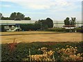

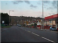

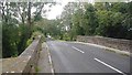
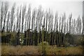


31 photos from this area
Area Information
Key information about the WA6 9NH including its size, population, and administrative classification.
- Area Type
- Postcode
- Area Size
- 2.0 hectares
- Population
- 1790
- Population Density
- 2589 people/km²
House Prices in WA6 9NH
12
Properties
£218,722
Average Sold Price
£120,000
Lowest Price
£450,499
Highest Price
Showing 12 properties
| Address | Type | Beds | Baths | Last Sale Price | Last Sale Date | |
|---|---|---|---|---|---|---|
| Quarry Cottage, Robin Hood Lane, Helsby, Frodsham, WA6 9NH | Detached | 1 | - | £132,000 | Mar 2021 | |
| Hill Field House, Robin Hood Lane, Helsby, Frodsham, WA6 9NH | house | - | - | £160,000 | Feb 2021 | |
| 106 Robin Hood Lane, Helsby, Frodsham, WA6 9NH | Detached | 4 | 2 | £450,499 | Dec 2017 | |
| 100 Robin Hood Lane, Helsby, Frodsham, WA6 9NH | Semi-detached | 4 | - | £411,000 | Sep 2012 | |
| Renbie, Robin Hood Lane, Helsby, Frodsham, WA6 9NH | Detached | - | - | £232,500 | Jan 2002 | |
| 98 Robin Hood Lane, Helsby, Frodsham, WA6 9NH | Semi-detached | - | - | £180,000 | May 2000 | |
| Sandy Mount, 94 Robin Hood Lane, Helsby, Frodsham, WA6 9NH | Semi-detached | - | - | £140,000 | Jan 1999 | |
| 96 Robin Hood Lane, Helsby, Frodsham, WA6 9NH | Semi-detached | - | - | £142,500 | Dec 1998 | |
| 92 Robin Hood Lane, Helsby, Frodsham, WA6 9NH | house | - | - | £120,000 | Jan 1996 | |
| Gorsehill, Robin Hood Lane, Helsby, Frodsham, WA6 9NH | Detached | 4 | 4 | - | - |
Page 1 of 2
Energy Efficiency in WA6 9NH
Amenities
Schools
| Rank | School | Type | Entry gender | Ages |
|---|
Explore more schools in this area
Go to Schools tabDemographics
Household Size
Two person
most common
Accommodation Type
Houses
most common
Tenure
80
majority
Ethnic Group
White
most common
Religion
N/A
most common
Household Composition
N/A
most common
Age
47
median
Adults (30-64 years)
most common
Household Deprivation
N/A
with no deprivation
NS-SEC
41
in Lower managerial occupations
Explore more demographic insights in this area
Go to Demographics tabPlanning
Planning Constraints
- Flood RiskPremium
- Ramsar Wetland SitesPremium
- Area of Outstanding Natural BeautyPremium
- Protected Nature ReservePremium
- Protected WoodlandPremium