Area Overview for WA4 5NU
Photos of WA4 5NU
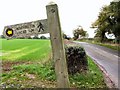
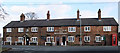
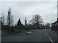
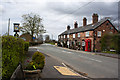
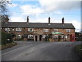
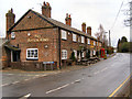


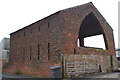
9 photos from this area
Area Information
Key information about the WA4 5NU including its size, population, and administrative classification.
- Area Type
- Postcode
- Area Size
- 12.8 hectares
- Population
- 1794
- Population Density
- 203 people/km²
House Prices in WA4 5NU
19
Properties
£371,375
Average Sold Price
£106,500
Lowest Price
£520,500
Highest Price
Showing 19 properties
| Address | Type | Beds | Baths | Last Sale Price | Last Sale Date | |
|---|---|---|---|---|---|---|
| Lyndon Lea, Warrington Road, Hatton, Warrington, WA4 5NU | Detached | 3 | 1 | £455,000 | Nov 2025 | |
| 1, Hewitts Cottage, Warrington Road, Hatton, Warrington, WA4 5NU | Semi-detached | 4 | 2 | £365,000 | Dec 2020 | |
| The Shop, Warrington Road, Hatton, Warrington, WA4 5NU | house | - | - | £414,000 | Sep 2019 | |
| Rivendell, Warrington Road, Hatton, Warrington, WA4 5NU | house | - | - | £325,000 | Mar 2018 | |
| Hollybank, Warrington Road, Hatton, Warrington, WA4 5NU | house | 5 | - | £315,000 | Jan 2018 | |
| White Croft, Warrington Road, Hatton, Warrington, WA4 5NU | Detached | 3 | - | £470,000 | Nov 2015 | |
| Fairlie Cottage, Warrington Road, Hatton, Warrington, WA4 5NU | house | 5 | - | £520,500 | Apr 2015 | |
| Croft Cottage, Warrington Road, Hatton, Warrington, WA4 5NU | Terraced | - | - | £106,500 | Mar 1997 | |
| Hatton Hall, Warrington Road, Hatton, Warrington, WA4 5NU | house | 2 | - | - | - | |
| High View, Hatton Hall, Warrington Road, Hatton, Warrington, WA4 5NU | Semi-detached | - | - | - | - |
Page 1 of 2
Energy Efficiency in WA4 5NU
Amenities
Schools
| Rank | School | Type | Entry gender | Ages |
|---|
Explore more schools in this area
Go to Schools tabDemographics
Household Size
Two person
most common
Accommodation Type
Houses
most common
Tenure
86
majority
Ethnic Group
White
most common
Religion
N/A
most common
Household Composition
N/A
most common
Age
47
median
Adults (30-64 years)
most common
Household Deprivation
N/A
with no deprivation
NS-SEC
56
in Lower managerial occupations
Explore more demographic insights in this area
Go to Demographics tabPlanning
Planning Constraints
- Flood RiskPremium
- Ramsar Wetland SitesPremium
- Area of Outstanding Natural BeautyPremium
- Protected Nature ReservePremium
- Protected WoodlandPremium