Area Overview for WA4 3EP
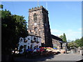
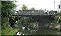
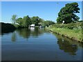
Photos of WA4 3EP
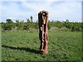
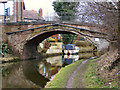
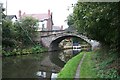

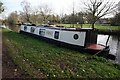
![Stanny Lunt Bridge [No 16], from the east in WA4 3EP](https://images.propbar.co.uk/images/geograph/68/57/6857514_120.jpg)
47 photos from this area
Area Information
Key information about the WA4 3EP including its size, population, and administrative classification.
- Area Type
- Postcode
- Area Size
- 8.5 hectares
- Population
- 1853
- Population Density
- 1131 people/km²
House Prices in WA4 3EP
14
Properties
£492,750
Average Sold Price
£223,000
Lowest Price
£895,000
Highest Price
Showing 14 properties
| Address | Type | Beds | Baths | Last Sale Price | Last Sale Date | |
|---|---|---|---|---|---|---|
| Ingleside, Church Lane, Grappenhall And Thelwall, Warrington, WA4 3EP | Retail | 4 | 2 | £647,500 | May 2022 | |
| 3 Church Lane, Grappenhall And Thelwall, Warrington, WA4 3EP | Detached | 5 | 3 | £650,000 | Sep 2020 | |
| The Poplars, Church Lane, Grappenhall And Thelwall, Warrington, WA4 3EP | house | 5 | - | £895,000 | Oct 2016 | |
| Birchfield, Church Lane, Grappenhall And Thelwall, Warrington, WA4 3EP | Semi-detached | 6 | 3 | £302,000 | Jun 2002 | |
| 1, Church Lane Cottage, Church Lane, Grappenhall And Thelwall, Warrington, WA4 3EP | Semi-detached | - | - | £223,000 | Jul 2001 | |
| 4 Church Lane, Grappenhall And Thelwall, Warrington, WA4 3EP | Semi-detached | - | - | £239,000 | Jul 1998 | |
| Scout Hut, Church Lane, Grappenhall And Thelwall, Warrington, WA4 3EP | commercial | - | - | - | - | |
| Church Cottage East, Church Lane, Grappenhall And Thelwall, Warrington, WA4 3EP | Semi-detached | - | - | - | - | |
| The Rectory, Church Lane, Grappenhall And Thelwall, Warrington, WA4 3EP | Detached | - | - | - | - | |
| Church Cottage West, Church Lane, Grappenhall And Thelwall, Warrington, WA4 3EP | Semi-detached | - | - | - | - |
Page 1 of 2
Energy Efficiency in WA4 3EP
Amenities
Schools
| Rank | School | Type | Entry gender | Ages |
|---|
Explore more schools in this area
Go to Schools tabDemographics
Household Size
Family (3-5 people)
most common
Accommodation Type
Houses
most common
Tenure
93
majority
Ethnic Group
White
most common
Religion
N/A
most common
Household Composition
N/A
most common
Age
47
median
Adults (30-64 years)
most common
Household Deprivation
N/A
with no deprivation
NS-SEC
51
in Lower managerial occupations
Explore more demographic insights in this area
Go to Demographics tabPlanning
Planning Constraints
- Flood RiskPremium
- Ramsar Wetland SitesPremium
- Area of Outstanding Natural BeautyPremium
- Protected Nature ReservePremium
- Protected WoodlandPremium