Area Overview for WA4 3DS
Photos of WA4 3DS
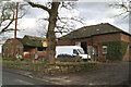
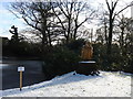
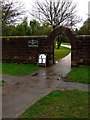
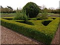
10 photos from this area
Area Information
Key information about the WA4 3DS including its size, population, and administrative classification.
- Area Type
- Postcode
- Area Size
- 5.1 hectares
- Population
- 1853
- Population Density
- 1131 people/km²
House Prices in WA4 3DS
25
Properties
£479,653
Average Sold Price
£190,000
Lowest Price
£760,000
Highest Price
Showing 25 properties
| Address | Type | Beds | Baths | Last Sale Price | Last Sale Date | |
|---|---|---|---|---|---|---|
| 37 Astor Drive, Warrington, WA4 3DS | Detached | 4 | 2 | £465,000 | Nov 2025 | |
| 47 Astor Drive, Warrington, WA4 3DS | Detached | 5 | 3 | £615,000 | Nov 2024 | |
| 39 Astor Drive, Warrington, WA4 3DS | Semi-detached | 4 | 2 | £505,000 | Aug 2024 | |
| 53 Astor Drive, Warrington, WA4 3DS | Detached | 4 | 2 | £468,495 | Nov 2021 | |
| 41 Astor Drive, Warrington, WA4 3DS | Flat | - | - | £190,000 | Sep 2021 | |
| 31 Astor Drive, Warrington, WA4 3DS | house | - | - | £760,000 | May 2021 | |
| 29 Astor Drive, Warrington, WA4 3DS | house | - | - | £660,000 | Oct 2019 | |
| 25 Astor Drive, Warrington, WA4 3DS | Detached | 5 | 4 | £630,000 | Apr 2019 | |
| 35 Astor Drive, Warrington, WA4 3DS | house | - | - | £480,000 | Mar 2017 | |
| 27 Astor Drive, Warrington, WA4 3DS | Detached | 5 | - | £537,000 | May 2014 |
Page 1 of 3
Energy Efficiency in WA4 3DS
Amenities
Schools
| Rank | School | Type | Entry gender | Ages |
|---|
Explore more schools in this area
Go to Schools tabDemographics
Household Size
Family (3-5 people)
most common
Accommodation Type
Houses
most common
Tenure
93
majority
Ethnic Group
White
most common
Religion
N/A
most common
Household Composition
N/A
most common
Age
47
median
Adults (30-64 years)
most common
Household Deprivation
N/A
with no deprivation
NS-SEC
51
in Lower managerial occupations
Explore more demographic insights in this area
Go to Demographics tabPlanning
Planning Constraints
- Flood RiskPremium
- Ramsar Wetland SitesPremium
- Area of Outstanding Natural BeautyPremium
- Protected Nature ReservePremium
- Protected WoodlandPremium